TKM2 KN.TKM2 - Earthquake Result Viewer
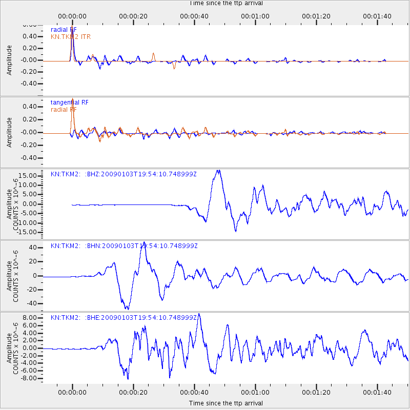
Earthquake location: Irian Jaya Region, Indonesia
Earthquake latitude/longitude: -0.4/132.9
Earthquake time(UTC): 2009/01/03 (003) 19:43:50 GMT
Earthquake Depth: 17 km
Earthquake Magnitude: 6.6 MB, 7.5 MS, 7.6 MW, 7.6 MW
Earthquake Catalog/Contributor: WHDF/NEIC
Network: KN Kyrgyz Seismic Telemetry Network
Station: TKM2 KN.TKM2
Lat/Lon: 42.92 N/75.60 E
Elevation: 2020 m
Distance: 66.9 deg
Az: 317.789 deg
Baz: 113.849 deg
Ray Param: 0.057284072
Estimated Moho Depth: 29.25 km
Estimated Crust Vp/Vs: 2.10
Assumed Crust Vp: 6.306 km/s
Estimated Crust Vs: 3.006 km/s
Estimated Crust Poisson's Ratio: 0.35
Radial Match: 98.19008 %
Radial Bump: 323
Transverse Match: 91.43681 %
Transverse Bump: 400
SOD ConfigId: 2834
Insert Time: 2010-03-08 21:04:24.108 +0000
GWidth: 2.5
Max Bumps: 400
Tol: 0.001

Signal To Noise

ChannelStoNSTALTA
KN:TKM2: :BHN:20090103T19:54:10.748999Z6.20557265.9426196E-79.576263E-8
KN:TKM2: :BHE:20090103T19:54:10.748999Z1.24811428.61569E-86.902965E-8
KN:TKM2: :BHZ:20090103T19:54:10.748999Z2.56981022.207209E-78.5889965E-8
Arrivals
Ps5.3 SECOND
PpPs14 SECOND
PsPs/PpSs19 SECOND