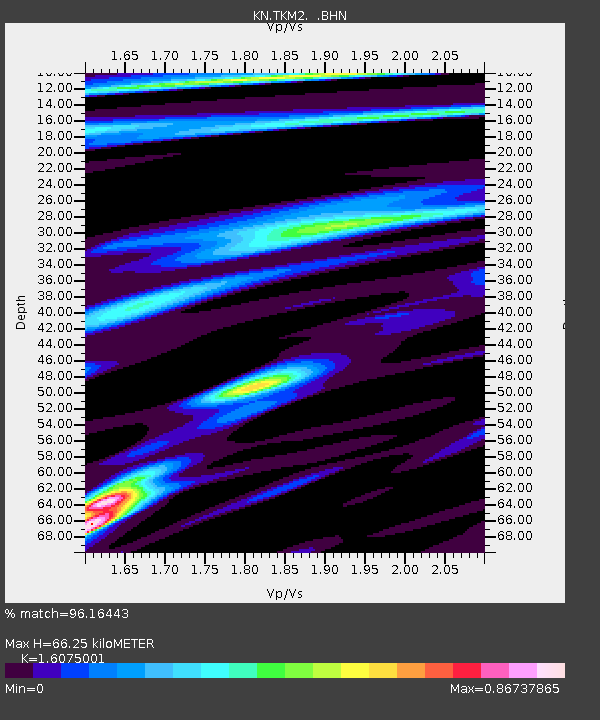
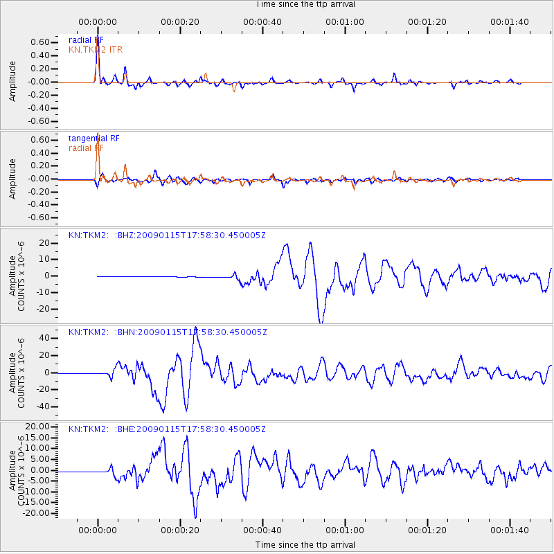
TKM2 KN.TKM2 - Earthquake Result Viewer

Earthquake location: East Of Kuril Islands
Earthquake latitude/longitude: 46.9/155.2
Earthquake time(UTC): 2009/01/15 (015) 17:49:39 GMT
Earthquake Depth: 36 km
Earthquake Magnitude: 6.9 MB, 7.5 MS, 7.4 MW, 7.4 MW
Earthquake Catalog/Contributor: WHDF/NEIC
Network: KN Kyrgyz Seismic Telemetry Network
Station: TKM2 KN.TKM2
Lat/Lon: 42.92 N/75.60 E
Elevation: 2020 m
Distance: 54.2 deg
Az: 297.046 deg
Baz: 56.312 deg
Ray Param: 0.06552731
Estimated Moho Depth: 66.25 km
Estimated Crust Vp/Vs: 1.61
Assumed Crust Vp: 6.306 km/s
Estimated Crust Vs: 3.923 km/s
Estimated Crust Poisson's Ratio: 0.18
Radial Match: 96.16443 %
Radial Bump: 348
Transverse Match: 90.446465 %
Transverse Bump: 400
SOD ConfigId: 2834
Insert Time: 2010-03-08 21:04:30.017 +0000
GWidth: 2.5
Max Bumps: 400
Tol: 0.001

Signal To Noise

ChannelStoNSTALTA
KN:TKM2: :BHN:20090115T17:58:30.450005Z34.5511864.6809937E-61.3547998E-7
KN:TKM2: :BHE:20090115T17:58:30.450005Z38.377211.6921683E-64.4093053E-8
KN:TKM2: :BHZ:20090115T17:58:30.450005Z11.3727451.5311801E-61.3463594E-7
Arrivals
Ps6.8 SECOND
PpPs26 SECOND
PsPs/PpSs33 SECOND