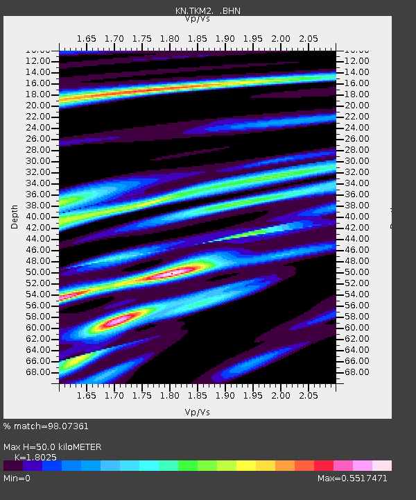
TKM2 KN.TKM2 - Earthquake Result Viewer
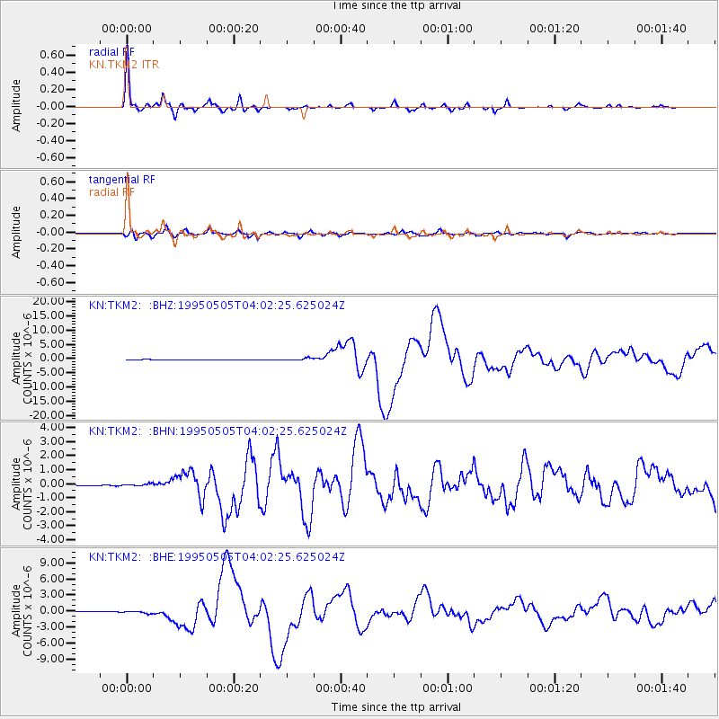
Earthquake location: Samar, Philippines
Earthquake latitude/longitude: 12.6/125.3
Earthquake time(UTC): 1995/05/05 (125) 03:53:47 GMT
Earthquake Depth: 33 km
Earthquake Magnitude: 6.2 MB, 7.0 MS, 7.1 UNKNOWN, 7.0 MW
Earthquake Catalog/Contributor: WHDF/NEIC
Network: KN Kyrgyz Seismic Telemetry Network
Station: TKM2 KN.TKM2
Lat/Lon: 42.92 N/75.60 E
Elevation: 2020 m
Distance: 52.3 deg
Az: 314.941 deg
Baz: 109.845 deg
Ray Param: 0.066759855
Estimated Moho Depth: 50.0 km
Estimated Crust Vp/Vs: 1.80
Assumed Crust Vp: 6.306 km/s
Estimated Crust Vs: 3.498 km/s
Estimated Crust Poisson's Ratio: 0.28
Radial Match: 98.07361 %
Radial Bump: 241
Transverse Match: 92.66709 %
Transverse Bump: 400
SOD ConfigId: 6273
Insert Time: 2010-03-08 21:05:08.706 +0000
GWidth: 2.5
Max Bumps: 400
Tol: 0.001

Signal To Noise

ChannelStoNSTALTA
KN:TKM2: :BHN:19950505T04:02:25.625024Z2.23433527.546341E-83.3774437E-8
KN:TKM2: :BHE:19950505T04:02:25.625024Z4.50075632.0728308E-74.6055167E-8
KN:TKM2: :BHZ:19950505T04:02:25.625024Z7.31687644.0524787E-75.5385364E-8
Arrivals
Ps6.7 SECOND
PpPs21 SECOND
PsPs/PpSs28 SECOND