
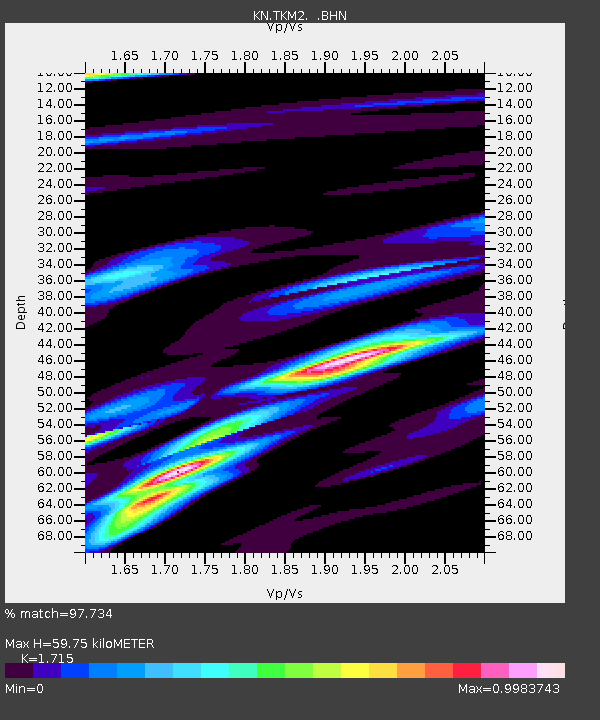
TKM2 KN.TKM2 - Earthquake Result Viewer
| ||||||||||||||||||
| ||||||||||||||||||
| ||||||||||||||||||
|
Signal To Noise
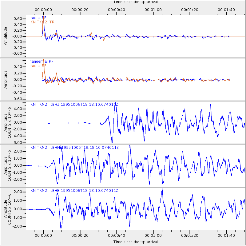
| Channel | StoN | STA | LTA |
| KN:TKM2: :BHN:19951006T18:18:10.074011Z | 1.3952057 | 1.5850763E-7 | 1.13608785E-7 |
| KN:TKM2: :BHE:19951006T18:18:10.074011Z | 2.0331109 | 1.2848207E-7 | 6.319482E-8 |
| KN:TKM2: :BHZ:19951006T18:18:10.074011Z | 7.9680734 | 3.9272248E-7 | 4.9287006E-8 |
| Arrivals | |
| Ps | 7.2 SECOND |
| PpPs | 24 SECOND |
| PsPs/PpSs | 31 SECOND |

