
TKM2 KN.TKM2 - Earthquake Result Viewer
| ||||||||||||||||||
| ||||||||||||||||||
| ||||||||||||||||||
|
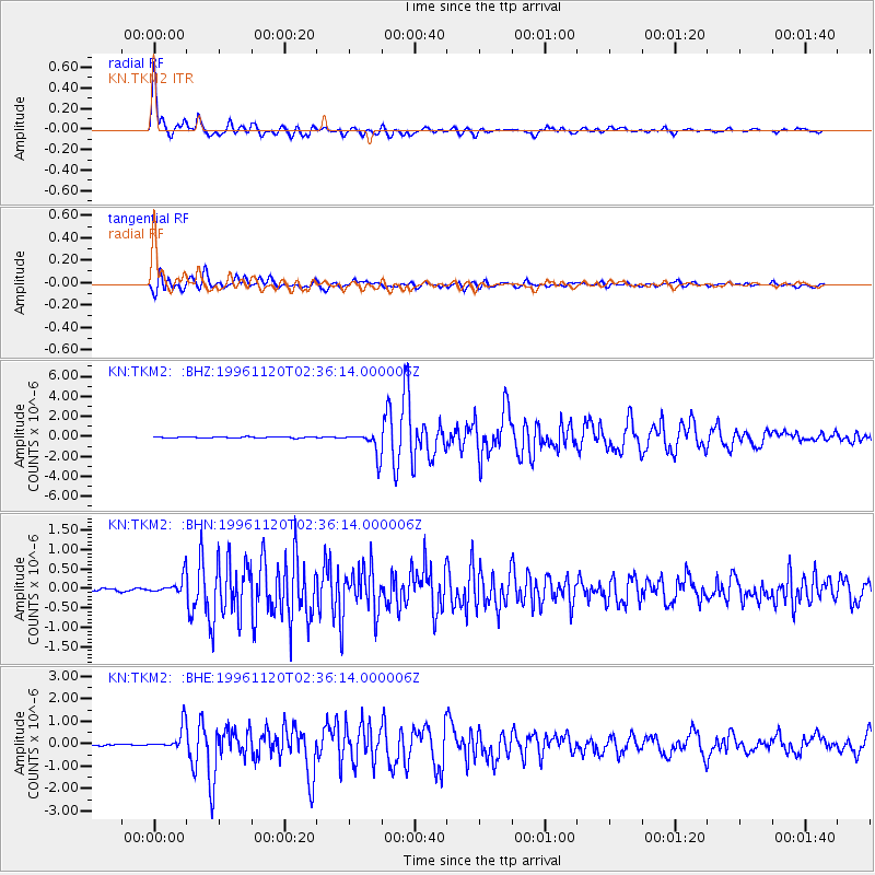
Signal To Noise
| Channel | StoN | STA | LTA |
| KN:TKM2: :BHN:19961120T02:36:14.000006Z | 4.591978 | 2.221061E-7 | 4.8368285E-8 |
| KN:TKM2: :BHE:19961120T02:36:14.000006Z | 16.117815 | 5.307329E-7 | 3.292834E-8 |
| KN:TKM2: :BHZ:19961120T02:36:14.000006Z | 21.045969 | 1.1674339E-6 | 5.5470665E-8 |
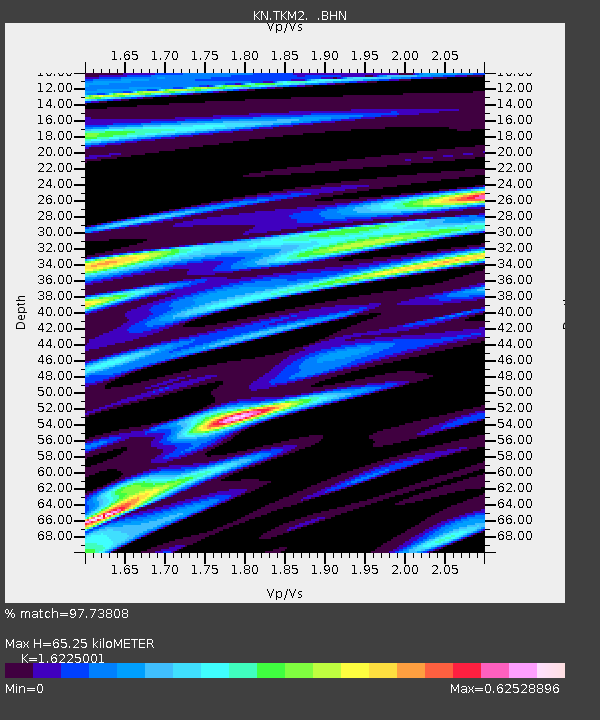
| Arrivals | |
| Ps | 6.8 SECOND |
| PpPs | 26 SECOND |
| PsPs/PpSs | 32 SECOND |

