
TKM2 KN.TKM2 - Earthquake Result Viewer
| ||||||||||||||||||
| ||||||||||||||||||
| ||||||||||||||||||
|
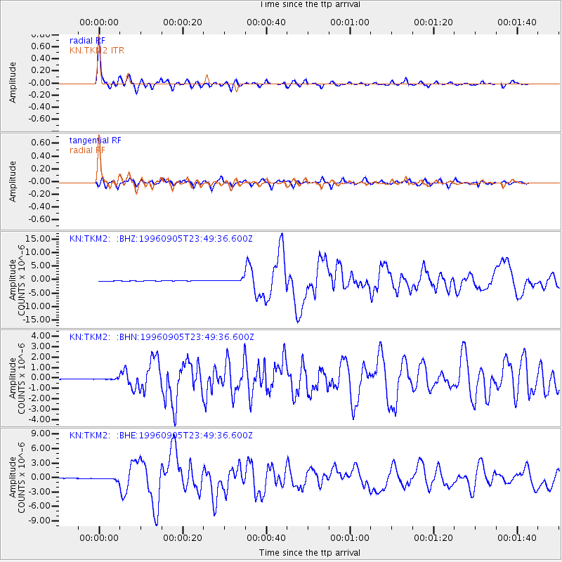
Signal To Noise
| Channel | StoN | STA | LTA |
| KN:TKM2: :BHN:19960905T23:49:36.600Z | 2.3401098 | 6.981654E-8 | 2.9834727E-8 |
| KN:TKM2: :BHE:19960905T23:49:36.600Z | 9.845526 | 3.0309297E-7 | 3.0784843E-8 |
| KN:TKM2: :BHZ:19960905T23:49:36.600Z | 17.181402 | 5.700497E-7 | 3.3178296E-8 |
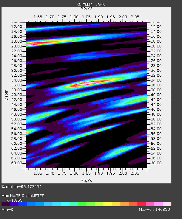
| Arrivals | |
| Ps | 5.0 SECOND |
| PpPs | 15 SECOND |
| PsPs/PpSs | 20 SECOND |

