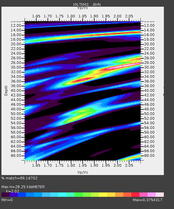
TKM2 KN.TKM2 - Earthquake Result Viewer
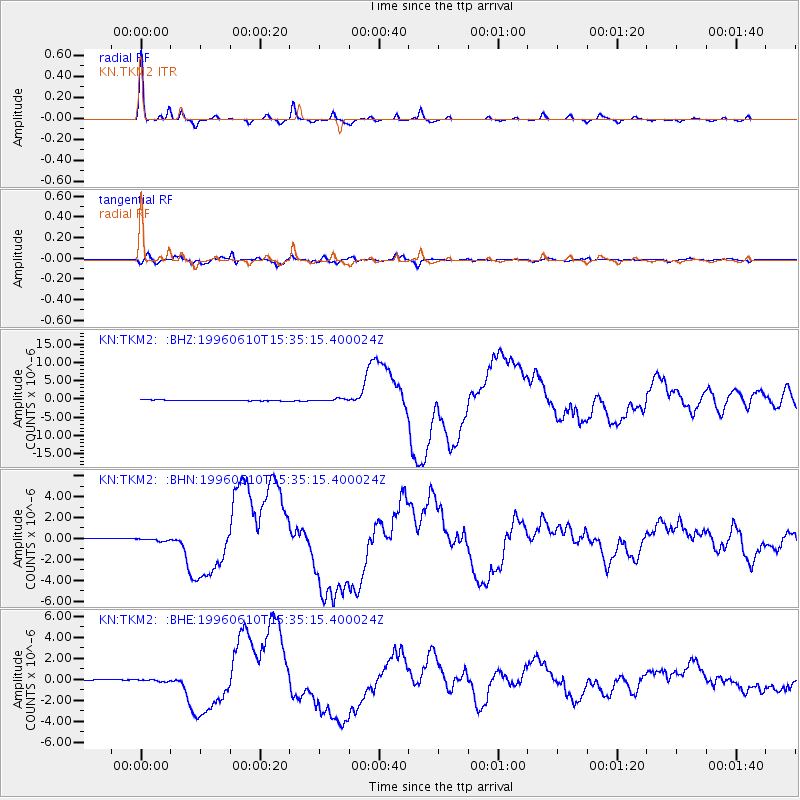
Earthquake location: Andreanof Islands, Aleutian Is.
Earthquake latitude/longitude: 51.5/-176.8
Earthquake time(UTC): 1996/06/10 (162) 15:24:56 GMT
Earthquake Depth: 26 km
Earthquake Magnitude: 5.9 MB, 7.1 MS, 7.2 UNKNOWN, 6.9 MS
Earthquake Catalog/Contributor: WHDF/NEIC
Network: KN Kyrgyz Seismic Telemetry Network
Station: TKM2 KN.TKM2
Lat/Lon: 42.92 N/75.60 E
Elevation: 2020 m
Distance: 67.0 deg
Az: 310.456 deg
Baz: 40.375 deg
Ray Param: 0.057214025
Estimated Moho Depth: 29.25 km
Estimated Crust Vp/Vs: 2.02
Assumed Crust Vp: 6.306 km/s
Estimated Crust Vs: 3.122 km/s
Estimated Crust Poisson's Ratio: 0.34
Radial Match: 99.16702 %
Radial Bump: 191
Transverse Match: 89.49633 %
Transverse Bump: 400
SOD ConfigId: 6273
Insert Time: 2010-03-08 21:06:18.043 +0000
GWidth: 2.5
Max Bumps: 400
Tol: 0.001

Signal To Noise

ChannelStoNSTALTA
KN:TKM2: :BHN:19960610T15:35:15.400024Z2.34755521.2410023E-75.28636E-8
KN:TKM2: :BHE:19960610T15:35:15.400024Z1.96150548.6987285E-84.4347207E-8
KN:TKM2: :BHZ:19960610T15:35:15.400024Z3.15148543.3537577E-71.0641832E-7
Arrivals
Ps4.9 SECOND
PpPs14 SECOND
PsPs/PpSs18 SECOND