
TKM2 KN.TKM2 - Earthquake Result Viewer
| ||||||||||||||||||
| ||||||||||||||||||
| ||||||||||||||||||
|
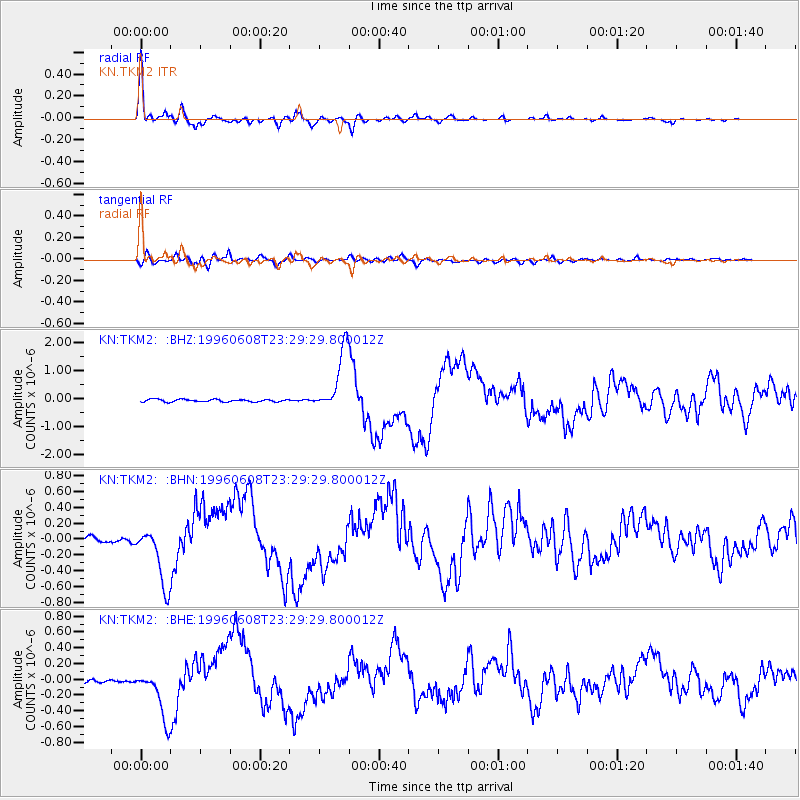
Signal To Noise
| Channel | StoN | STA | LTA |
| KN:TKM2: :BHN:19960608T23:29:29.800012Z | 13.604799 | 3.7356463E-7 | 2.7458299E-8 |
| KN:TKM2: :BHE:19960608T23:29:29.800012Z | 13.498872 | 3.1064877E-7 | 2.3012943E-8 |
| KN:TKM2: :BHZ:19960608T23:29:29.800012Z | 24.48085 | 1.0990519E-6 | 4.4894353E-8 |
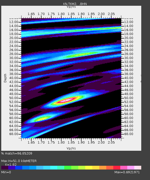
| Arrivals | |
| Ps | 6.9 SECOND |
| PpPs | 22 SECOND |
| PsPs/PpSs | 29 SECOND |

