
TKM2 KN.TKM2 - Earthquake Result Viewer
| ||||||||||||||||||
| ||||||||||||||||||
| ||||||||||||||||||
|
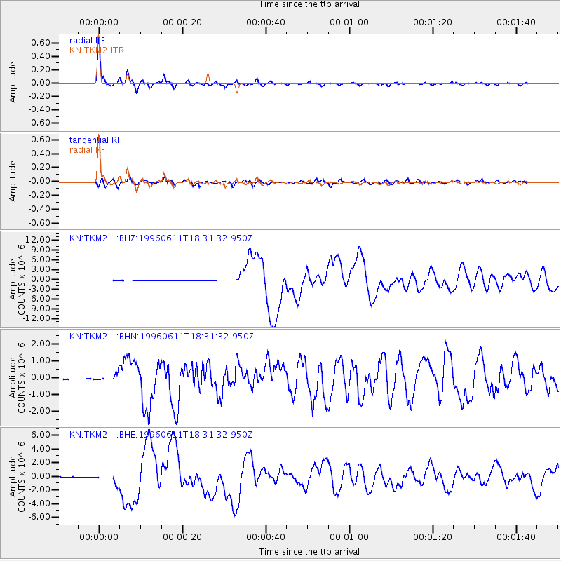
Signal To Noise
| Channel | StoN | STA | LTA |
| KN:TKM2: :BHN:19960611T18:31:32.950Z | 6.8109484 | 2.0248665E-7 | 2.972958E-8 |
| KN:TKM2: :BHE:19960611T18:31:32.950Z | 32.113937 | 6.869001E-7 | 2.1389468E-8 |
| KN:TKM2: :BHZ:19960611T18:31:32.950Z | 27.748327 | 1.4774953E-6 | 5.3246282E-8 |
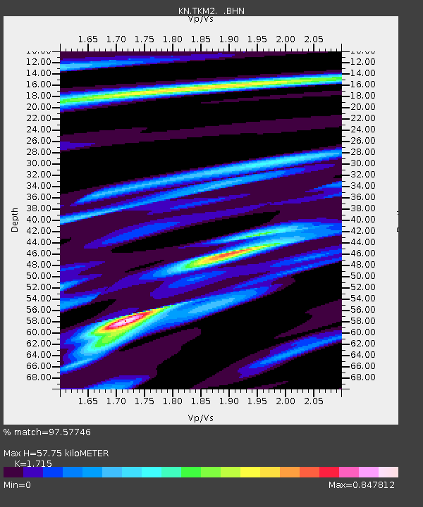
| Arrivals | |
| Ps | 6.9 SECOND |
| PpPs | 24 SECOND |
| PsPs/PpSs | 30 SECOND |

