
TKM2 KN.TKM2 - Earthquake Result Viewer
| ||||||||||||||||||
| ||||||||||||||||||
| ||||||||||||||||||
|
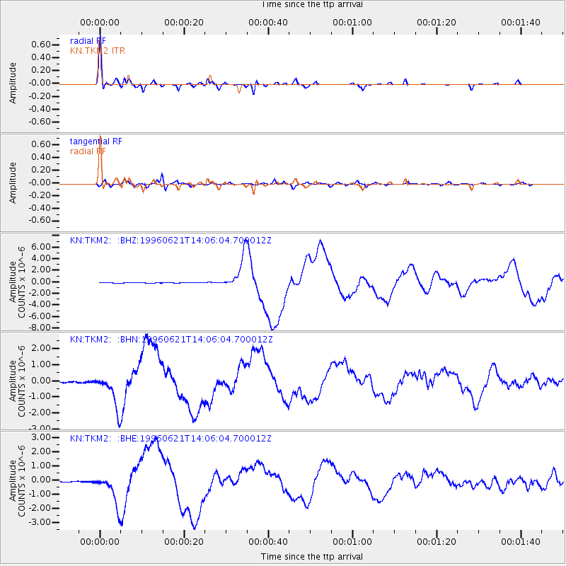
Signal To Noise
| Channel | StoN | STA | LTA |
| KN:TKM2: :BHN:19960621T14:06:04.700012Z | 35.060543 | 1.1112071E-6 | 3.169395E-8 |
| KN:TKM2: :BHE:19960621T14:06:04.700012Z | 34.55014 | 1.1345744E-6 | 3.283849E-8 |
| KN:TKM2: :BHZ:19960621T14:06:04.700012Z | 82.078354 | 3.014019E-6 | 3.6721243E-8 |
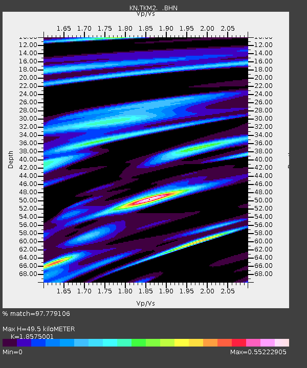
| Arrivals | |
| Ps | 7.1 SECOND |
| PpPs | 21 SECOND |
| PsPs/PpSs | 28 SECOND |

