You are here: Home > Network List > CN - Canadian National Seismograph Network Stations List
> Station INK INUVIK, NT > Earthquake Result Viewer
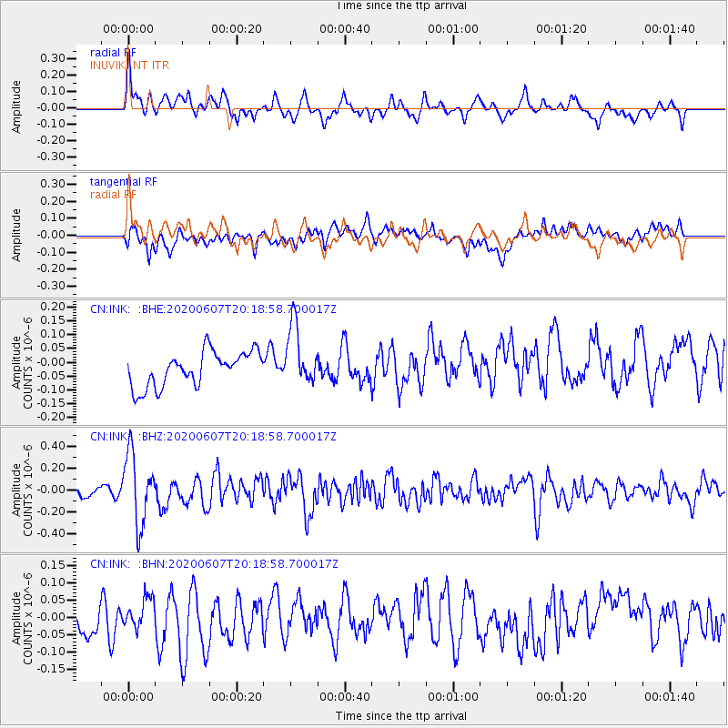
INK INUVIK, NT - Earthquake Result Viewer
*The percent match for this event was below the threshold and hence no stack was calculated.
| Earthquake location: |
New Britain Region, P.N.G. |
| Earthquake latitude/longitude: |
-5.4/151.7 |
| Earthquake time(UTC): |
2020/06/07 (159) 20:06:38 GMT |
| Earthquake Depth: |
53 km |
| Earthquake Magnitude: |
5.9 mww |
| Earthquake Catalog/Contributor: |
NEIC PDE/us |
|
| Network: |
CN Canadian National Seismograph Network |
| Station: |
INK INUVIK, NT |
| Lat/Lon: |
68.31 N/133.53 W |
| Elevation: |
44 m |
|
| Distance: |
89.4 deg |
| Az: |
21.028 deg |
| Baz: |
253.936 deg |
| Ray Param: |
$rayparam |
*The percent match for this event was below the threshold and hence was not used in the summary stack. |
|
| Radial Match: |
59.31241 % |
| Radial Bump: |
400 |
| Transverse Match: |
45.1976 % |
| Transverse Bump: |
400 |
| SOD ConfigId: |
21166931 |
| Insert Time: |
2020-06-21 20:15:09.012 +0000 |
| GWidth: |
2.5 |
| Max Bumps: |
400 |
| Tol: |
0.001 |
|
Signal To Noise
| Channel | StoN | STA | LTA |
| CN:INK: :BHZ:20200607T20:18:58.700017Z | 4.9485087 | 3.280849E-7 | 6.629975E-8 |
| CN:INK: :BHN:20200607T20:18:58.700017Z | 0.6126515 | 4.1053166E-8 | 6.7009005E-8 |
| CN:INK: :BHE:20200607T20:18:58.700017Z | 1.7741776 | 1.1066588E-7 | 6.2375875E-8 |
| Arrivals |
| Ps | |
| PpPs | |
| PsPs/PpSs | |


