
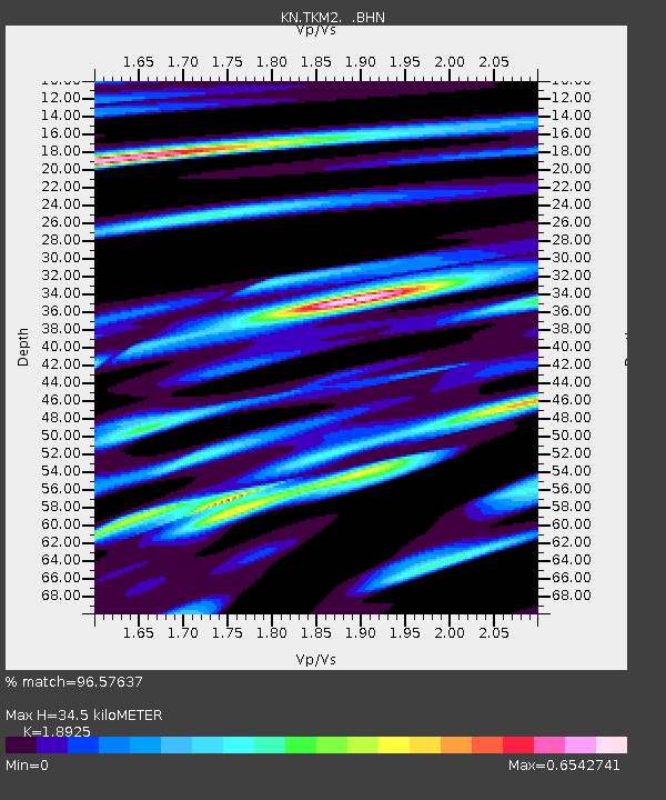
TKM2 KN.TKM2 - Earthquake Result Viewer
| ||||||||||||||||||
| ||||||||||||||||||
| ||||||||||||||||||
|
Signal To Noise
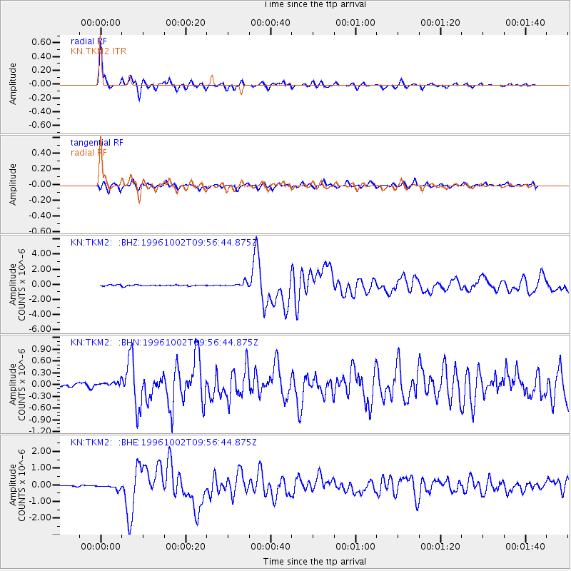
| Channel | StoN | STA | LTA |
| KN:TKM2: :BHN:19961002T09:56:44.875Z | 1.8683947 | 8.2063146E-8 | 4.3921737E-8 |
| KN:TKM2: :BHE:19961002T09:56:44.875Z | 3.2866597 | 1.4147324E-7 | 4.3044686E-8 |
| KN:TKM2: :BHZ:19961002T09:56:44.875Z | 4.09978 | 3.0693536E-7 | 7.486629E-8 |
| Arrivals | |
| Ps | 5.1 SECOND |
| PpPs | 15 SECOND |
| PsPs/PpSs | 20 SECOND |

