
TKM2 KN.TKM2 - Earthquake Result Viewer
| ||||||||||||||||||
| ||||||||||||||||||
| ||||||||||||||||||
|
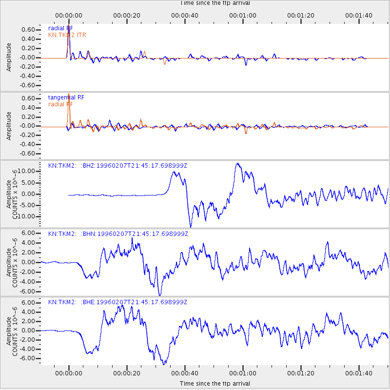
Signal To Noise
| Channel | StoN | STA | LTA |
| KN:TKM2: :BHN:19960207T21:45:17.698999Z | 4.036336 | 4.8234466E-7 | 1.1950061E-7 |
| KN:TKM2: :BHE:19960207T21:45:17.698999Z | 5.1453466 | 6.084153E-7 | 1.18245744E-7 |
| KN:TKM2: :BHZ:19960207T21:45:17.698999Z | 9.65761 | 1.5078099E-6 | 1.5612662E-7 |
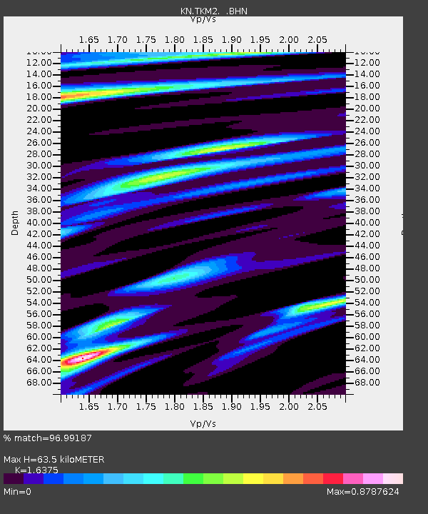
| Arrivals | |
| Ps | 6.8 SECOND |
| PpPs | 25 SECOND |
| PsPs/PpSs | 32 SECOND |

