TKM2 KN.TKM2 - Earthquake Result Viewer
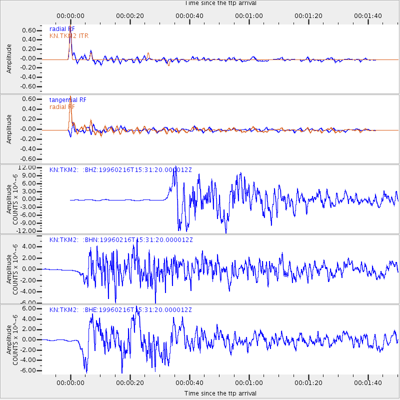
Earthquake location: Off East Coast Of Honshu, Japan
Earthquake latitude/longitude: 37.3/142.5
Earthquake time(UTC): 1996/02/16 (047) 15:22:57 GMT
Earthquake Depth: 33 km
Earthquake Magnitude: 6.2 MB, 6.2 MS, 6.7 UNKNOWN, 6.6 MW
Earthquake Catalog/Contributor: WHDF/NEIC
Network: KN Kyrgyz Seismic Telemetry Network
Station: TKM2 KN.TKM2
Lat/Lon: 42.92 N/75.60 E
Elevation: 2020 m
Distance: 50.2 deg
Az: 298.483 deg
Baz: 72.484 deg
Ray Param: 0.068133585
Estimated Moho Depth: 54.0 km
Estimated Crust Vp/Vs: 1.76
Assumed Crust Vp: 6.306 km/s
Estimated Crust Vs: 3.573 km/s
Estimated Crust Poisson's Ratio: 0.26
Radial Match: 97.82422 %
Radial Bump: 377
Transverse Match: 89.73628 %
Transverse Bump: 400
SOD ConfigId: 6273
Insert Time: 2010-03-08 21:07:17.922 +0000
GWidth: 2.5
Max Bumps: 400
Tol: 0.001

Signal To Noise

ChannelStoNSTALTA
KN:TKM2: :BHN:19960216T15:31:20.000012Z4.3982997.728334E-71.7571188E-7
KN:TKM2: :BHE:19960216T15:31:20.000012Z18.8986361.6956974E-68.9725916E-8
KN:TKM2: :BHZ:19960216T15:31:20.000012Z32.578243.6841934E-61.1308756E-7
Arrivals
Ps6.9 SECOND
PpPs22 SECOND
PsPs/PpSs29 SECOND