You are here: Home > Network List > TA - USArray Transportable Network (new EarthScope stations) Stations List
> Station F21K Alatna River, AK, USA > Earthquake Result Viewer
F21K Alatna River, AK, USA - Earthquake Result Viewer
*The percent match for this event was below the threshold and hence no stack was calculated.
| Earthquake location: |
New Britain Region, P.N.G. |
| Earthquake latitude/longitude: |
-5.4/151.7 |
| Earthquake time(UTC): |
2020/06/07 (159) 20:06:38 GMT |
| Earthquake Depth: |
53 km |
| Earthquake Magnitude: |
5.9 mww |
| Earthquake Catalog/Contributor: |
NEIC PDE/us |
|
| Network: |
TA USArray Transportable Network (new EarthScope stations) |
| Station: |
F21K Alatna River, AK, USA |
| Lat/Lon: |
67.22 N/153.48 W |
| Elevation: |
597 m |
|
| Distance: |
82.1 deg |
| Az: |
18.75 deg |
| Baz: |
235.283 deg |
| Ray Param: |
$rayparam |
*The percent match for this event was below the threshold and hence was not used in the summary stack. |
|
| Radial Match: |
73.20826 % |
| Radial Bump: |
400 |
| Transverse Match: |
65.851006 % |
| Transverse Bump: |
400 |
| SOD ConfigId: |
21166931 |
| Insert Time: |
2020-06-21 20:21:03.179 +0000 |
| GWidth: |
2.5 |
| Max Bumps: |
400 |
| Tol: |
0.001 |
|
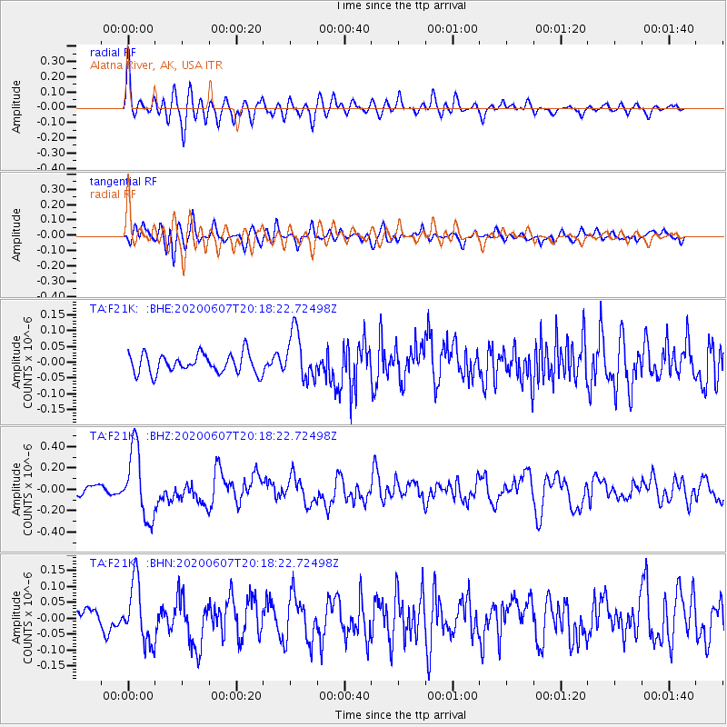
Signal To Noise
| Channel | StoN | STA | LTA |
| TA:F21K: :BHZ:20200607T20:18:22.72498Z | 6.7778378 | 3.2811337E-7 | 4.8409746E-8 |
| TA:F21K: :BHN:20200607T20:18:22.72498Z | 3.1479988 | 9.5973995E-8 | 3.0487303E-8 |
| TA:F21K: :BHE:20200607T20:18:22.72498Z | 2.5114105 | 7.6657884E-8 | 3.0523836E-8 |
| Arrivals |
| Ps | |
| PpPs | |
| PsPs/PpSs | |


