TKM2 KN.TKM2 - Earthquake Result Viewer
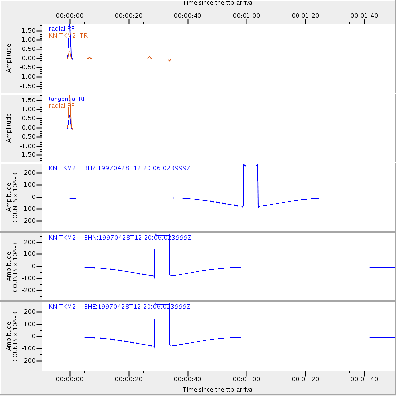
Earthquake location: Prince Edward Islands Region
Earthquake latitude/longitude: -42.5/42.7
Earthquake time(UTC): 1997/04/28 (118) 12:07:37 GMT
Earthquake Depth: 10 km
Earthquake Magnitude: 5.7 MB, 6.3 MS, 6.8 UNKNOWN, 6.5 MW
Earthquake Catalog/Contributor: WHDF/NEIC
Network: KN Kyrgyz Seismic Telemetry Network
Station: TKM2 KN.TKM2
Lat/Lon: 42.92 N/75.60 E
Elevation: 2020 m
Distance: 90.0 deg
Az: 23.523 deg
Baz: 203.69 deg
Ray Param: 0.041701604
Estimated Moho Depth: 10.0 km
Estimated Crust Vp/Vs: 1.60
Assumed Crust Vp: 6.306 km/s
Estimated Crust Vs: 3.941 km/s
Estimated Crust Poisson's Ratio: 0.18
Radial Match: 100.0 %
Radial Bump: 2
Transverse Match: 100.0 %
Transverse Bump: 2
SOD ConfigId: 6273
Insert Time: 2010-03-08 21:07:42.352 +0000
GWidth: 2.5
Max Bumps: 400
Tol: 0.001

Signal To Noise

ChannelStoNSTALTA
KN:TKM2: :BHN:19970428T12:20:06.023999Z0.825832250.00227637660.0027564638
KN:TKM2: :BHE:19970428T12:20:06.023999Z0.825827660.00227638170.0027564852
KN:TKM2: :BHZ:19970428T12:20:06.023999Z0.82581240.0022763340.0027564785
Arrivals
Ps1.0 SECOND
PpPs4.0 SECOND
PsPs/PpSs5.0 SECOND