You are here: Home > Network List > TA - USArray Transportable Network (new EarthScope stations) Stations List
> Station K13K Kusilvak Mountain, AK, USA > Earthquake Result Viewer
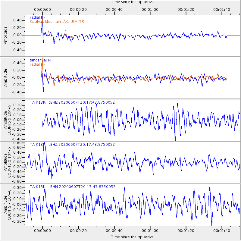
K13K Kusilvak Mountain, AK, USA - Earthquake Result Viewer
*The percent match for this event was below the threshold and hence no stack was calculated.
| Earthquake location: |
New Britain Region, P.N.G. |
| Earthquake latitude/longitude: |
-5.4/151.7 |
| Earthquake time(UTC): |
2020/06/07 (159) 20:06:38 GMT |
| Earthquake Depth: |
53 km |
| Earthquake Magnitude: |
5.9 mww |
| Earthquake Catalog/Contributor: |
NEIC PDE/us |
|
| Network: |
TA USArray Transportable Network (new EarthScope stations) |
| Station: |
K13K Kusilvak Mountain, AK, USA |
| Lat/Lon: |
61.93 N/164.66 W |
| Elevation: |
204 m |
|
| Distance: |
75.0 deg |
| Az: |
19.765 deg |
| Baz: |
225.39 deg |
| Ray Param: |
$rayparam |
*The percent match for this event was below the threshold and hence was not used in the summary stack. |
|
| Radial Match: |
74.68893 % |
| Radial Bump: |
400 |
| Transverse Match: |
68.93037 % |
| Transverse Bump: |
400 |
| SOD ConfigId: |
21166931 |
| Insert Time: |
2020-06-21 20:21:56.867 +0000 |
| GWidth: |
2.5 |
| Max Bumps: |
400 |
| Tol: |
0.001 |
|
Signal To Noise
| Channel | StoN | STA | LTA |
| TA:K13K: :BHZ:20200607T20:17:43.875005Z | 3.2865207 | 4.2485004E-7 | 1.2927046E-7 |
| TA:K13K: :BHN:20200607T20:17:43.875005Z | 1.4802765 | 1.4788327E-7 | 9.990246E-8 |
| TA:K13K: :BHE:20200607T20:17:43.875005Z | 1.1220014 | 1.4737333E-7 | 1.3134861E-7 |
| Arrivals |
| Ps | |
| PpPs | |
| PsPs/PpSs | |


