You are here: Home > Network List > US - United States National Seismic Network Stations List
> Station HAWA Hanford, Washington, USA > Earthquake Result Viewer
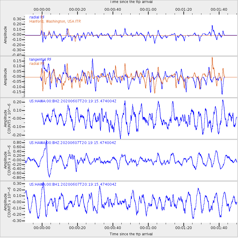
HAWA Hanford, Washington, USA - Earthquake Result Viewer
*The percent match for this event was below the threshold and hence no stack was calculated.
| Earthquake location: |
New Britain Region, P.N.G. |
| Earthquake latitude/longitude: |
-5.4/151.7 |
| Earthquake time(UTC): |
2020/06/07 (159) 20:06:38 GMT |
| Earthquake Depth: |
53 km |
| Earthquake Magnitude: |
5.9 mww |
| Earthquake Catalog/Contributor: |
NEIC PDE/us |
|
| Network: |
US United States National Seismic Network |
| Station: |
HAWA Hanford, Washington, USA |
| Lat/Lon: |
46.39 N/119.53 W |
| Elevation: |
364 m |
|
| Distance: |
93.0 deg |
| Az: |
43.864 deg |
| Baz: |
265.447 deg |
| Ray Param: |
$rayparam |
*The percent match for this event was below the threshold and hence was not used in the summary stack. |
|
| Radial Match: |
62.889313 % |
| Radial Bump: |
400 |
| Transverse Match: |
57.754818 % |
| Transverse Bump: |
400 |
| SOD ConfigId: |
21166931 |
| Insert Time: |
2020-06-21 20:23:53.406 +0000 |
| GWidth: |
2.5 |
| Max Bumps: |
400 |
| Tol: |
0.001 |
|
Signal To Noise
| Channel | StoN | STA | LTA |
| US:HAWA:00:BHZ:20200607T20:19:15.474004Z | 4.202396 | 4.978778E-7 | 1.1847475E-7 |
| US:HAWA:00:BH1:20200607T20:19:15.474004Z | 1.8493849 | 1.613352E-7 | 8.723722E-8 |
| US:HAWA:00:BH2:20200607T20:19:15.474004Z | 0.9056093 | 5.8071663E-8 | 6.4124414E-8 |
| Arrivals |
| Ps | |
| PpPs | |
| PsPs/PpSs | |


