TKM2 KN.TKM2 - Earthquake Result Viewer
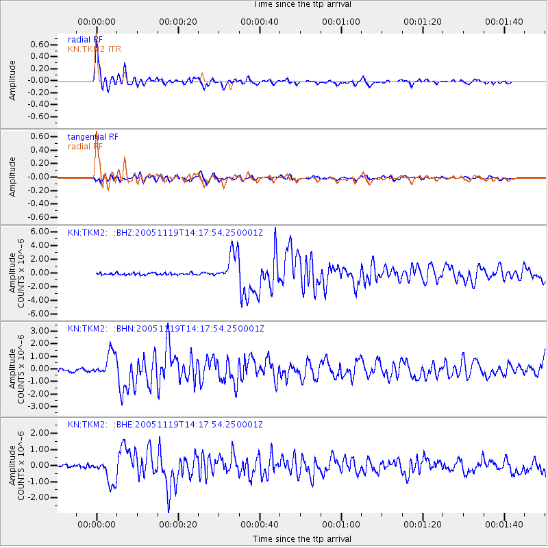
Earthquake location: Northern Sumatra, Indonesia
Earthquake latitude/longitude: 2.2/96.8
Earthquake time(UTC): 2005/11/19 (323) 14:10:13 GMT
Earthquake Depth: 21 km
Earthquake Magnitude: 6.0 MB, 6.1 MS, 6.5 MW, 6.5 MW
Earthquake Catalog/Contributor: WHDF/NEIC
Network: KN Kyrgyz Seismic Telemetry Network
Station: TKM2 KN.TKM2
Lat/Lon: 42.92 N/75.60 E
Elevation: 2020 m
Distance: 44.8 deg
Az: 337.854 deg
Baz: 149.148 deg
Ray Param: 0.07168066
Estimated Moho Depth: 61.0 km
Estimated Crust Vp/Vs: 1.68
Assumed Crust Vp: 6.306 km/s
Estimated Crust Vs: 3.754 km/s
Estimated Crust Poisson's Ratio: 0.23
Radial Match: 96.18993 %
Radial Bump: 400
Transverse Match: 88.72993 %
Transverse Bump: 400
SOD ConfigId: 2448
Insert Time: 2010-03-08 21:08:56.694 +0000
GWidth: 2.5
Max Bumps: 400
Tol: 0.001

Signal To Noise

ChannelStoNSTALTA
KN:TKM2: :BHN:20051119T14:17:54.250001Z8.0344979.91628E-71.234213E-7
KN:TKM2: :BHE:20051119T14:17:54.250001Z11.8424057.913225E-76.68211E-8
KN:TKM2: :BHZ:20051119T14:17:54.250001Z18.0079672.3375028E-61.2980381E-7
Arrivals
Ps7.0 SECOND
PpPs24 SECOND
PsPs/PpSs31 SECOND