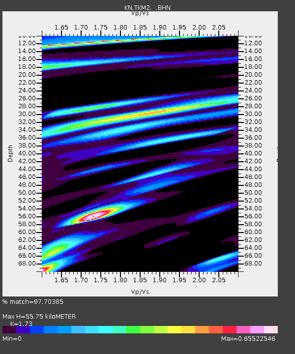
TKM2 KN.TKM2 - Earthquake Result Viewer
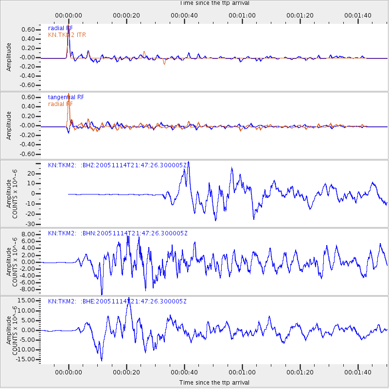
Earthquake location: Off East Coast Of Honshu, Japan
Earthquake latitude/longitude: 38.1/144.9
Earthquake time(UTC): 2005/11/14 (318) 21:38:51 GMT
Earthquake Depth: 11 km
Earthquake Magnitude: 6.7 MB, 6.8 MS, 7.0 MW, 6.9 MW
Earthquake Catalog/Contributor: WHDF/NEIC
Network: KN Kyrgyz Seismic Telemetry Network
Station: TKM2 KN.TKM2
Lat/Lon: 42.92 N/75.60 E
Elevation: 2020 m
Distance: 51.5 deg
Az: 298.667 deg
Baz: 70.437 deg
Ray Param: 0.06733989
Estimated Moho Depth: 55.75 km
Estimated Crust Vp/Vs: 1.73
Assumed Crust Vp: 6.306 km/s
Estimated Crust Vs: 3.645 km/s
Estimated Crust Poisson's Ratio: 0.25
Radial Match: 97.70385 %
Radial Bump: 400
Transverse Match: 93.01781 %
Transverse Bump: 400
SOD ConfigId: 2448
Insert Time: 2010-03-08 21:08:58.064 +0000
GWidth: 2.5
Max Bumps: 400
Tol: 0.001

Signal To Noise

ChannelStoNSTALTA
KN:TKM2: :BHN:20051114T21:47:26.300005Z3.19074564.6418103E-71.4547729E-7
KN:TKM2: :BHE:20051114T21:47:26.300005Z5.9667086.007131E-71.00677475E-7
KN:TKM2: :BHZ:20051114T21:47:26.300005Z9.653011.4623756E-61.5149425E-7
Arrivals
Ps6.8 SECOND
PpPs23 SECOND
PsPs/PpSs30 SECOND