
TKM2 KN.TKM2 - Earthquake Result Viewer
| ||||||||||||||||||
| ||||||||||||||||||
| ||||||||||||||||||
|
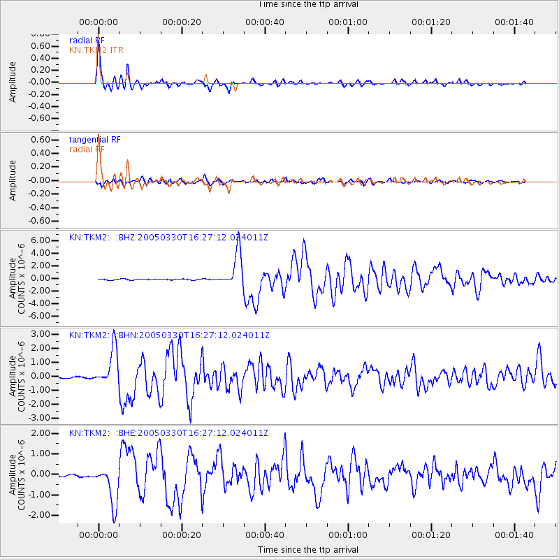
Signal To Noise
| Channel | StoN | STA | LTA |
| KN:TKM2: :BHN:20050330T16:27:12.024011Z | 27.377356 | 1.3957134E-6 | 5.0980578E-8 |
| KN:TKM2: :BHE:20050330T16:27:12.024011Z | 23.418844 | 1.018503E-6 | 4.3490743E-8 |
| KN:TKM2: :BHZ:20050330T16:27:12.024011Z | 36.406586 | 3.009456E-6 | 8.266241E-8 |
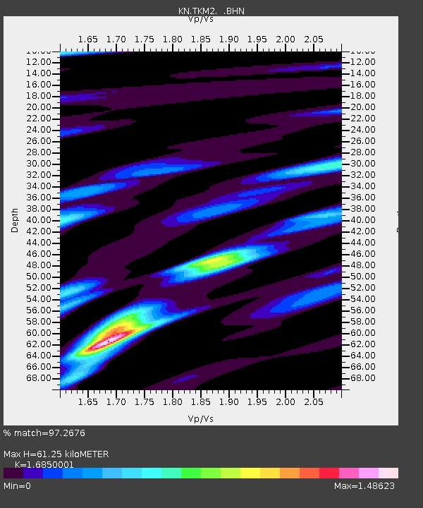
| Arrivals | |
| Ps | 7.1 SECOND |
| PpPs | 24 SECOND |
| PsPs/PpSs | 32 SECOND |

