
TKM2 KN.TKM2 - Earthquake Result Viewer
| ||||||||||||||||||
| ||||||||||||||||||
| ||||||||||||||||||
|
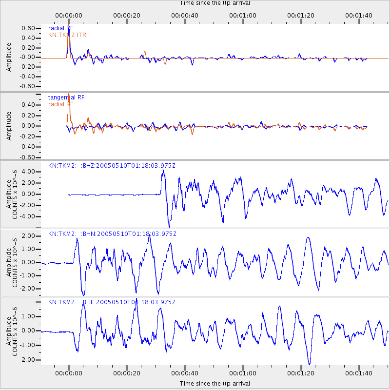
Signal To Noise
| Channel | StoN | STA | LTA |
| KN:TKM2: :BHN:20050510T01:18:03.975Z | 36.505417 | 1.0186375E-6 | 2.7903738E-8 |
| KN:TKM2: :BHE:20050510T01:18:03.975Z | 51.44153 | 8.023786E-7 | 1.5597877E-8 |
| KN:TKM2: :BHZ:20050510T01:18:03.975Z | 87.89174 | 2.6371542E-6 | 3.0004575E-8 |
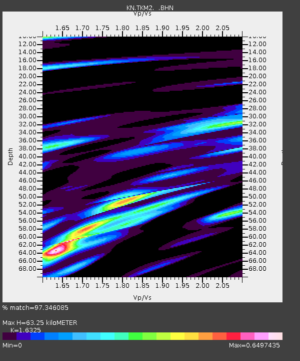
| Arrivals | |
| Ps | 6.7 SECOND |
| PpPs | 25 SECOND |
| PsPs/PpSs | 32 SECOND |

