
TKM2 KN.TKM2 - Earthquake Result Viewer
| ||||||||||||||||||
| ||||||||||||||||||
| ||||||||||||||||||
|
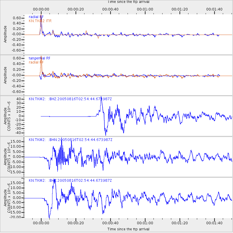
Signal To Noise
| Channel | StoN | STA | LTA |
| KN:TKM2: :BHN:20050816T02:54:44.673987Z | 100.23118 | 3.3761091E-6 | 3.3683225E-8 |
| KN:TKM2: :BHE:20050816T02:54:44.673987Z | 88.91844 | 6.6996563E-6 | 7.534609E-8 |
| KN:TKM2: :BHZ:20050816T02:54:44.673987Z | 125.265144 | 1.4859772E-5 | 1.1862655E-7 |
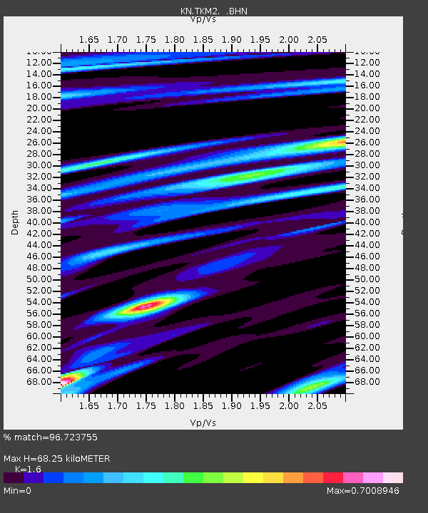
| Arrivals | |
| Ps | 6.9 SECOND |
| PpPs | 26 SECOND |
| PsPs/PpSs | 33 SECOND |

