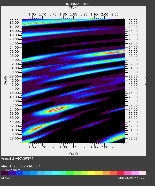
TKM2 KN.TKM2 - Earthquake Result Viewer
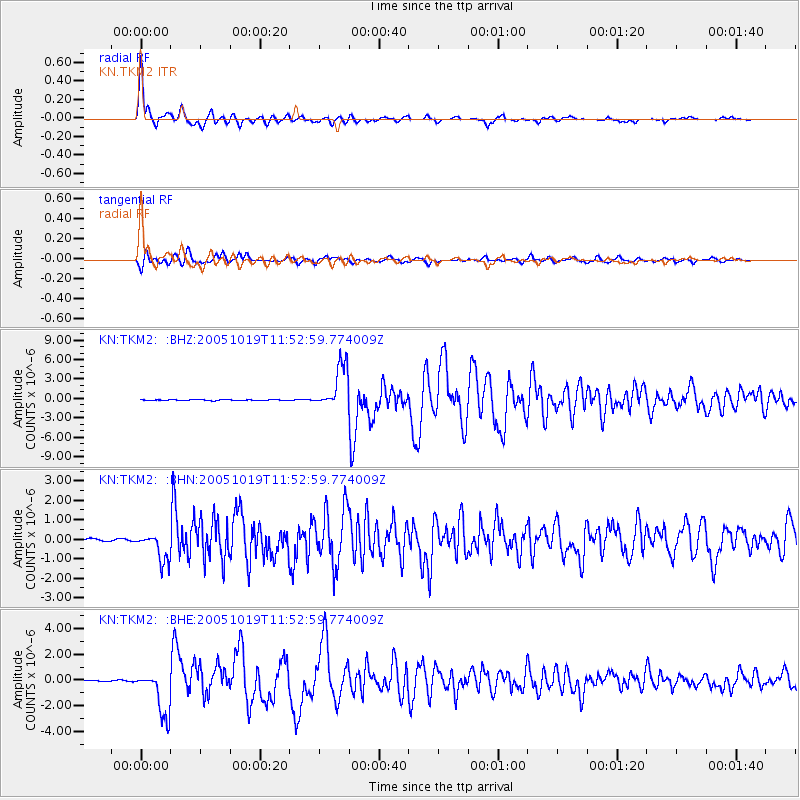
Earthquake location: Near East Coast Of Honshu, Japan
Earthquake latitude/longitude: 36.4/140.8
Earthquake time(UTC): 2005/10/19 (292) 11:44:42 GMT
Earthquake Depth: 32 km
Earthquake Magnitude: 6.2 MB, 6.5 MS, 6.4 MW, 6.3 MW
Earthquake Catalog/Contributor: WHDF/NEIC
Network: KN Kyrgyz Seismic Telemetry Network
Station: TKM2 KN.TKM2
Lat/Lon: 42.92 N/75.60 E
Elevation: 2020 m
Distance: 49.5 deg
Az: 298.728 deg
Baz: 74.38 deg
Ray Param: 0.0685859
Estimated Moho Depth: 25.75 km
Estimated Crust Vp/Vs: 2.09
Assumed Crust Vp: 6.306 km/s
Estimated Crust Vs: 3.021 km/s
Estimated Crust Poisson's Ratio: 0.35
Radial Match: 97.39574 %
Radial Bump: 357
Transverse Match: 92.33927 %
Transverse Bump: 400
SOD ConfigId: 2475
Insert Time: 2010-03-08 21:10:11.545 +0000
GWidth: 2.5
Max Bumps: 400
Tol: 0.001

Signal To Noise

ChannelStoNSTALTA
KN:TKM2: :BHN:20051019T11:52:59.774009Z11.8662287.3370916E-76.1831706E-8
KN:TKM2: :BHE:20051019T11:52:59.774009Z41.2775841.7600247E-64.2638753E-8
KN:TKM2: :BHZ:20051019T11:52:59.774009Z62.8024983.4412958E-65.4795525E-8
Arrivals
Ps4.7 SECOND
PpPs12 SECOND
PsPs/PpSs17 SECOND