
TKM2 KN.TKM2 - Earthquake Result Viewer
| ||||||||||||||||||
| ||||||||||||||||||
| ||||||||||||||||||
|
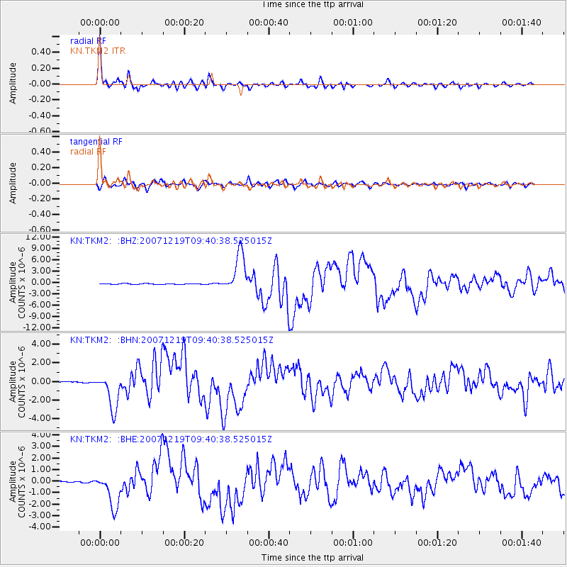
Signal To Noise
| Channel | StoN | STA | LTA |
| KN:TKM2: :BHN:20071219T09:40:38.525015Z | 44.403423 | 2.020687E-6 | 4.550746E-8 |
| KN:TKM2: :BHE:20071219T09:40:38.525015Z | 25.480597 | 1.5706137E-6 | 6.16396E-8 |
| KN:TKM2: :BHZ:20071219T09:40:38.525015Z | 48.232887 | 5.4012753E-6 | 1.1198324E-7 |
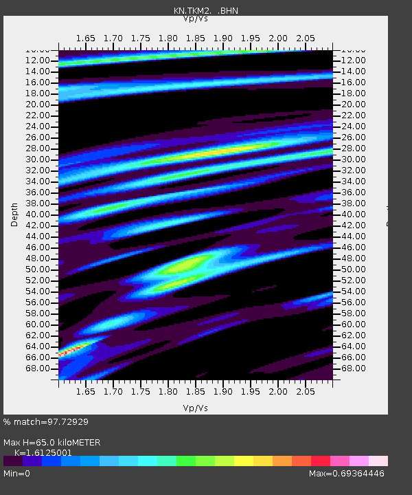
| Arrivals | |
| Ps | 6.6 SECOND |
| PpPs | 26 SECOND |
| PsPs/PpSs | 32 SECOND |

