
TKM2 KN.TKM2 - Earthquake Result Viewer
| ||||||||||||||||||
| ||||||||||||||||||
| ||||||||||||||||||
|
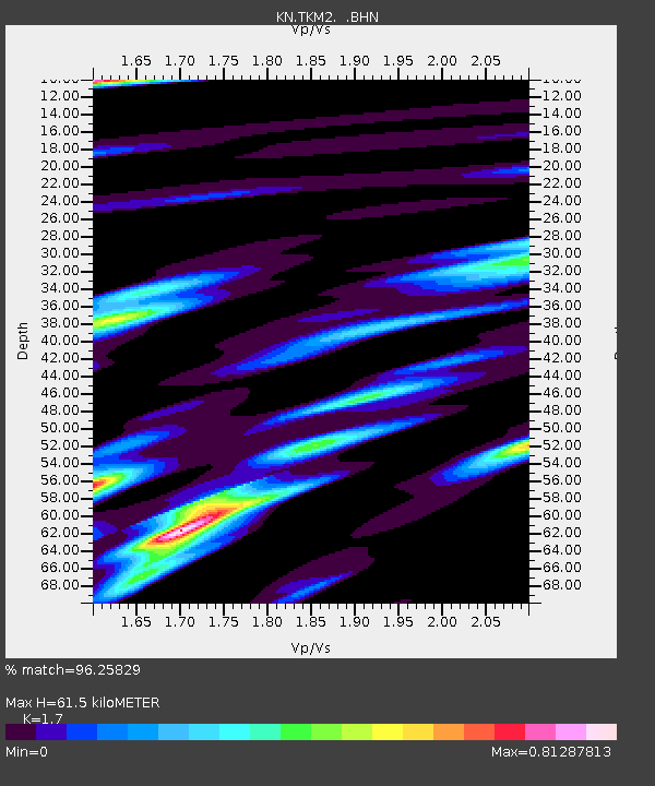
Signal To Noise
| Channel | StoN | STA | LTA |
| KN:TKM2: :BHN:20071002T03:52:18.60001Z | 23.345072 | 7.7314246E-7 | 3.3118017E-8 |
| KN:TKM2: :BHE:20071002T03:52:18.60001Z | 16.839285 | 5.4757436E-7 | 3.2517672E-8 |
| KN:TKM2: :BHZ:20071002T03:52:18.60001Z | 34.74726 | 1.8372217E-6 | 5.2873858E-8 |
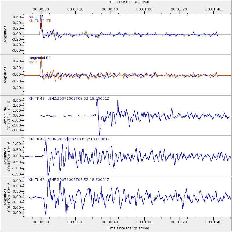
| Arrivals | |
| Ps | 7.2 SECOND |
| PpPs | 25 SECOND |
| PsPs/PpSs | 32 SECOND |

