
TKM2 KN.TKM2 - Earthquake Result Viewer
| ||||||||||||||||||
| ||||||||||||||||||
| ||||||||||||||||||
|
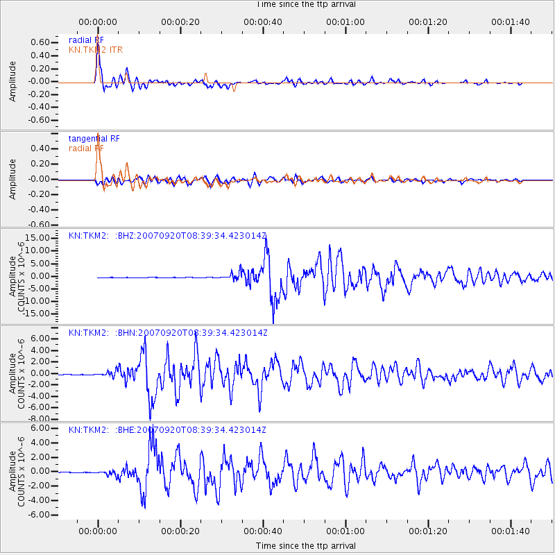
Signal To Noise
| Channel | StoN | STA | LTA |
| KN:TKM2: :BHN:20070920T08:39:34.423014Z | 11.7242565 | 4.4789644E-7 | 3.8202547E-8 |
| KN:TKM2: :BHE:20070920T08:39:34.423014Z | 7.2469306 | 3.2038855E-7 | 4.421024E-8 |
| KN:TKM2: :BHZ:20070920T08:39:34.423014Z | 31.033203 | 1.4752602E-6 | 4.7538123E-8 |
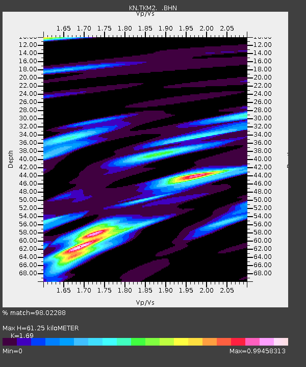
| Arrivals | |
| Ps | 7.1 SECOND |
| PpPs | 25 SECOND |
| PsPs/PpSs | 32 SECOND |

