
TKM2 KN.TKM2 - Earthquake Result Viewer
| ||||||||||||||||||
| ||||||||||||||||||
| ||||||||||||||||||
|
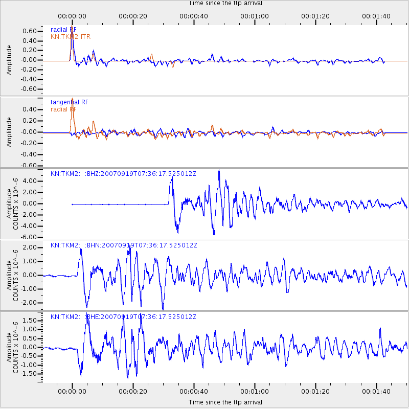
Signal To Noise
| Channel | StoN | STA | LTA |
| KN:TKM2: :BHN:20070919T07:36:17.525012Z | 28.213861 | 1.0126026E-6 | 3.5890256E-8 |
| KN:TKM2: :BHE:20070919T07:36:17.525012Z | 21.410254 | 7.915348E-7 | 3.696989E-8 |
| KN:TKM2: :BHZ:20070919T07:36:17.525012Z | 71.135506 | 2.4787676E-6 | 3.4845716E-8 |
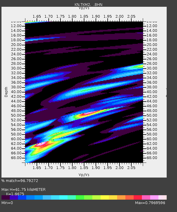
| Arrivals | |
| Ps | 6.9 SECOND |
| PpPs | 25 SECOND |
| PsPs/PpSs | 32 SECOND |

