You are here: Home > Network List > TA - USArray Transportable Network (new EarthScope stations) Stations List
> Station C16K Lisburne Hills, AK, USA > Earthquake Result Viewer
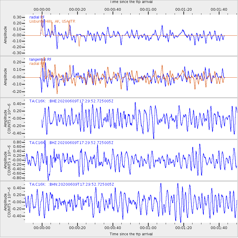
C16K Lisburne Hills, AK, USA - Earthquake Result Viewer
*The percent match for this event was below the threshold and hence no stack was calculated.
| Earthquake location: |
Southern Iran |
| Earthquake latitude/longitude: |
27.7/53.4 |
| Earthquake time(UTC): |
2020/06/09 (161) 17:18:14 GMT |
| Earthquake Depth: |
10 km |
| Earthquake Magnitude: |
5.7 Mww |
| Earthquake Catalog/Contributor: |
NEIC PDE/us |
|
| Network: |
TA USArray Transportable Network (new EarthScope stations) |
| Station: |
C16K Lisburne Hills, AK, USA |
| Lat/Lon: |
68.27 N/165.34 W |
| Elevation: |
102 m |
|
| Distance: |
80.1 deg |
| Az: |
13.692 deg |
| Baz: |
325.699 deg |
| Ray Param: |
$rayparam |
*The percent match for this event was below the threshold and hence was not used in the summary stack. |
|
| Radial Match: |
43.04394 % |
| Radial Bump: |
400 |
| Transverse Match: |
54.375256 % |
| Transverse Bump: |
400 |
| SOD ConfigId: |
21166931 |
| Insert Time: |
2020-06-23 17:29:43.123 +0000 |
| GWidth: |
2.5 |
| Max Bumps: |
400 |
| Tol: |
0.001 |
|
Signal To Noise
| Channel | StoN | STA | LTA |
| TA:C16K: :BHZ:20200609T17:29:52.725005Z | 2.658336 | 4.4794922E-7 | 1.6850738E-7 |
| TA:C16K: :BHN:20200609T17:29:52.725005Z | 1.4507946 | 2.14463E-7 | 1.4782451E-7 |
| TA:C16K: :BHE:20200609T17:29:52.725005Z | 1.1370983 | 1.8967208E-7 | 1.6680359E-7 |
| Arrivals |
| Ps | |
| PpPs | |
| PsPs/PpSs | |


