
TKM2 KN.TKM2 - Earthquake Result Viewer
| ||||||||||||||||||
| ||||||||||||||||||
| ||||||||||||||||||
|
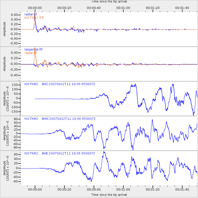
Signal To Noise
| Channel | StoN | STA | LTA |
| KN:TKM2: :BHN:20070912T11:19:06.650007Z | 5.5218945 | 8.9943825E-7 | 1.6288581E-7 |
| KN:TKM2: :BHE:20070912T11:19:06.650007Z | 5.2301693 | 7.5426294E-7 | 1.4421387E-7 |
| KN:TKM2: :BHZ:20070912T11:19:06.650007Z | 4.7955422 | 1.6420292E-6 | 3.4240742E-7 |
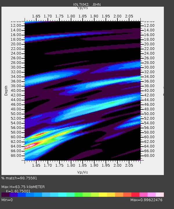
| Arrivals | |
| Ps | 6.6 SECOND |
| PpPs | 25 SECOND |
| PsPs/PpSs | 32 SECOND |

