You are here: Home > Network List > TA - USArray Transportable Network (new EarthScope stations) Stations List
> Station G21K Allakaket, AK, USA > Earthquake Result Viewer
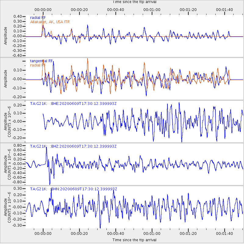
G21K Allakaket, AK, USA - Earthquake Result Viewer
*The percent match for this event was below the threshold and hence no stack was calculated.
| Earthquake location: |
Southern Iran |
| Earthquake latitude/longitude: |
27.7/53.4 |
| Earthquake time(UTC): |
2020/06/09 (161) 17:18:14 GMT |
| Earthquake Depth: |
10 km |
| Earthquake Magnitude: |
5.7 Mww |
| Earthquake Catalog/Contributor: |
NEIC PDE/us |
|
| Network: |
TA USArray Transportable Network (new EarthScope stations) |
| Station: |
G21K Allakaket, AK, USA |
| Lat/Lon: |
66.52 N/153.51 W |
| Elevation: |
446 m |
|
| Distance: |
83.8 deg |
| Az: |
10.522 deg |
| Baz: |
336.179 deg |
| Ray Param: |
$rayparam |
*The percent match for this event was below the threshold and hence was not used in the summary stack. |
|
| Radial Match: |
59.98616 % |
| Radial Bump: |
400 |
| Transverse Match: |
70.11381 % |
| Transverse Bump: |
400 |
| SOD ConfigId: |
21166931 |
| Insert Time: |
2020-06-23 17:30:51.163 +0000 |
| GWidth: |
2.5 |
| Max Bumps: |
400 |
| Tol: |
0.001 |
|
Signal To Noise
| Channel | StoN | STA | LTA |
| TA:G21K: :BHZ:20200609T17:30:12.399993Z | 5.2702036 | 3.36611E-7 | 6.387059E-8 |
| TA:G21K: :BHN:20200609T17:30:12.399993Z | 2.5297275 | 1.14663884E-7 | 4.532658E-8 |
| TA:G21K: :BHE:20200609T17:30:12.399993Z | 1.4052124 | 6.7617165E-8 | 4.811882E-8 |
| Arrivals |
| Ps | |
| PpPs | |
| PsPs/PpSs | |


