You are here: Home > Network List > TA - USArray Transportable Network (new EarthScope stations) Stations List
> Station I30M Mount Dempster, Yukon, CAN > Earthquake Result Viewer
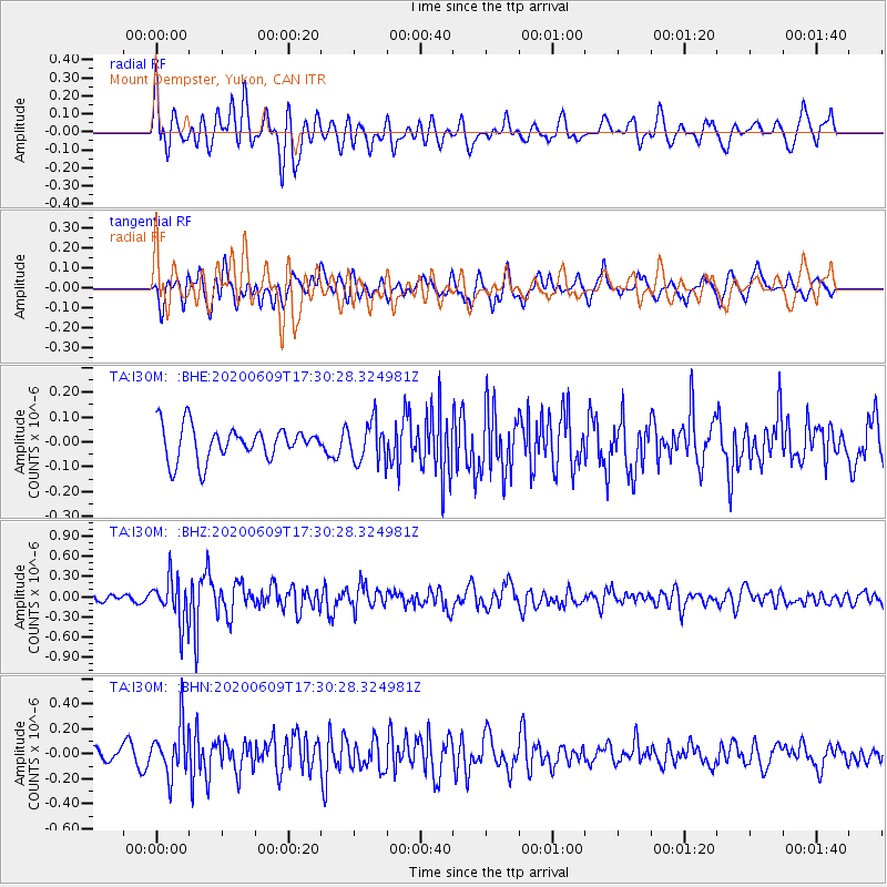
I30M Mount Dempster, Yukon, CAN - Earthquake Result Viewer
*The percent match for this event was below the threshold and hence no stack was calculated.
| Earthquake location: |
Southern Iran |
| Earthquake latitude/longitude: |
27.7/53.4 |
| Earthquake time(UTC): |
2020/06/09 (161) 17:18:14 GMT |
| Earthquake Depth: |
10 km |
| Earthquake Magnitude: |
5.7 Mww |
| Earthquake Catalog/Contributor: |
NEIC PDE/us |
|
| Network: |
TA USArray Transportable Network (new EarthScope stations) |
| Station: |
I30M Mount Dempster, Yukon, CAN |
| Lat/Lon: |
65.22 N/136.38 W |
| Elevation: |
1399 m |
|
| Distance: |
87.0 deg |
| Az: |
4.122 deg |
| Baz: |
351.304 deg |
| Ray Param: |
$rayparam |
*The percent match for this event was below the threshold and hence was not used in the summary stack. |
|
| Radial Match: |
71.06958 % |
| Radial Bump: |
400 |
| Transverse Match: |
70.99518 % |
| Transverse Bump: |
400 |
| SOD ConfigId: |
21166931 |
| Insert Time: |
2020-06-23 17:31:19.910 +0000 |
| GWidth: |
2.5 |
| Max Bumps: |
400 |
| Tol: |
0.001 |
|
Signal To Noise
| Channel | StoN | STA | LTA |
| TA:I30M: :BHZ:20200609T17:30:28.324981Z | 4.009975 | 3.345809E-7 | 8.343716E-8 |
| TA:I30M: :BHN:20200609T17:30:28.324981Z | 3.3179424 | 2.0021302E-7 | 6.034252E-8 |
| TA:I30M: :BHE:20200609T17:30:28.324981Z | 1.20592 | 8.100065E-8 | 6.716917E-8 |
| Arrivals |
| Ps | |
| PpPs | |
| PsPs/PpSs | |


