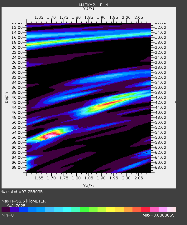
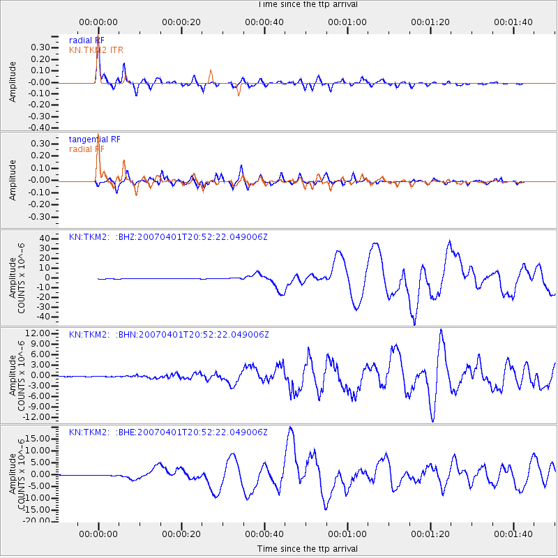
TKM2 KN.TKM2 - Earthquake Result Viewer

Earthquake location: Solomon Islands
Earthquake latitude/longitude: -8.5/157.0
Earthquake time(UTC): 2007/04/01 (091) 20:39:56 GMT
Earthquake Depth: 10 km
Earthquake Magnitude: 6.8 MB, 7.9 MS, 8.1 MW, 7.7 ME
Earthquake Catalog/Contributor: WHDF/NEIC
Network: KN Kyrgyz Seismic Telemetry Network
Station: TKM2 KN.TKM2
Lat/Lon: 42.92 N/75.60 E
Elevation: 2020 m
Distance: 89.5 deg
Az: 313.412 deg
Baz: 101.958 deg
Ray Param: 0.04181211
Estimated Moho Depth: 55.5 km
Estimated Crust Vp/Vs: 1.70
Assumed Crust Vp: 6.306 km/s
Estimated Crust Vs: 3.704 km/s
Estimated Crust Poisson's Ratio: 0.24
Radial Match: 97.255035 %
Radial Bump: 322
Transverse Match: 93.34944 %
Transverse Bump: 400
SOD ConfigId: 2564
Insert Time: 2010-03-08 21:12:05.002 +0000
GWidth: 2.5
Max Bumps: 400
Tol: 0.001

Signal To Noise

ChannelStoNSTALTA
KN:TKM2: :BHN:20070401T20:52:22.049006Z0.99900767.940051E-87.9479385E-8
KN:TKM2: :BHE:20070401T20:52:22.049006Z3.16635271.8335504E-75.790733E-8
KN:TKM2: :BHZ:20070401T20:52:22.049006Z5.5772825.7356493E-71.0283951E-7
Arrivals
Ps6.3 SECOND
PpPs23 SECOND
PsPs/PpSs30 SECOND