You are here: Home > Network List > TA - USArray Transportable Network (new EarthScope stations) Stations List
> Station E20K Nigu River, AK, USA > Earthquake Result Viewer
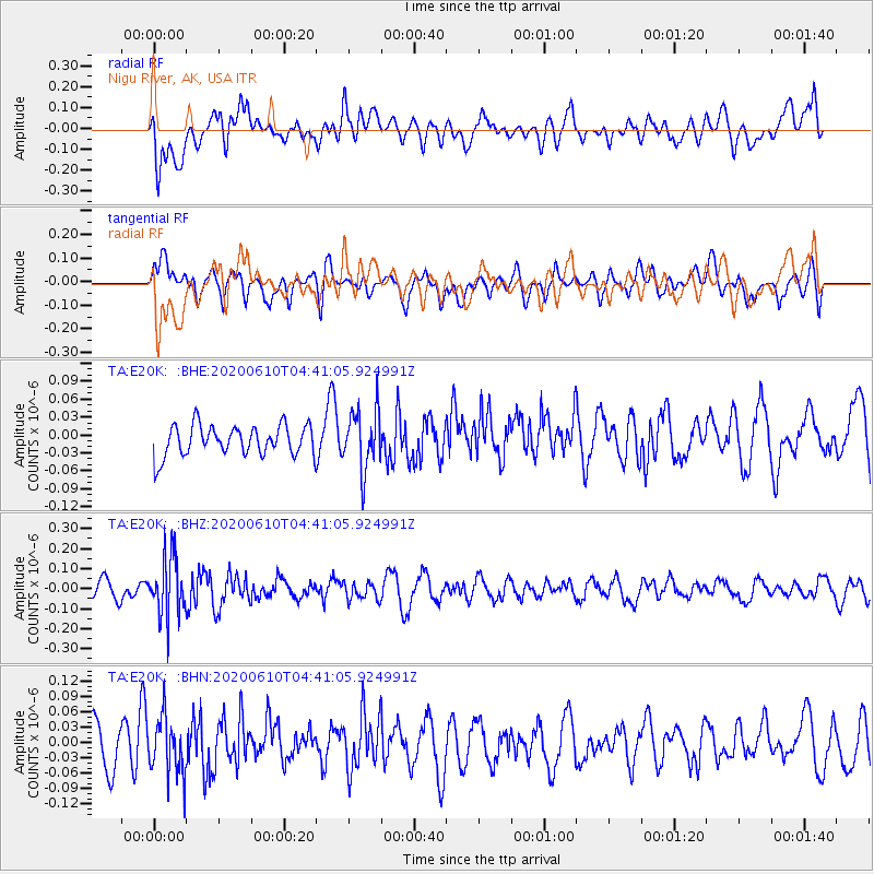
E20K Nigu River, AK, USA - Earthquake Result Viewer
*The percent match for this event was below the threshold and hence no stack was calculated.
| Earthquake location: |
South Of Fiji Islands |
| Earthquake latitude/longitude: |
-23.5/179.2 |
| Earthquake time(UTC): |
2020/06/10 (162) 04:29:20 GMT |
| Earthquake Depth: |
539 km |
| Earthquake Magnitude: |
5.9 Mww |
| Earthquake Catalog/Contributor: |
NEIC PDE/us |
|
| Network: |
TA USArray Transportable Network (new EarthScope stations) |
| Station: |
E20K Nigu River, AK, USA |
| Lat/Lon: |
68.26 N/156.19 W |
| Elevation: |
866 m |
|
| Distance: |
93.3 deg |
| Az: |
8.933 deg |
| Baz: |
202.493 deg |
| Ray Param: |
$rayparam |
*The percent match for this event was below the threshold and hence was not used in the summary stack. |
|
| Radial Match: |
48.58693 % |
| Radial Bump: |
400 |
| Transverse Match: |
61.210556 % |
| Transverse Bump: |
400 |
| SOD ConfigId: |
21166931 |
| Insert Time: |
2020-06-24 04:42:51.078 +0000 |
| GWidth: |
2.5 |
| Max Bumps: |
400 |
| Tol: |
0.001 |
|
Signal To Noise
| Channel | StoN | STA | LTA |
| TA:E20K: :BHZ:20200610T04:41:05.924991Z | 2.2989595 | 1.5063162E-7 | 6.5521654E-8 |
| TA:E20K: :BHN:20200610T04:41:05.924991Z | 0.9420035 | 5.515634E-8 | 5.8552164E-8 |
| TA:E20K: :BHE:20200610T04:41:05.924991Z | 1.9714092 | 5.0119677E-8 | 2.5423274E-8 |
| Arrivals |
| Ps | |
| PpPs | |
| PsPs/PpSs | |


