You are here: Home > Network List > US - United States National Seismic Network Stations List
> Station HAWA Hanford, Washington, USA > Earthquake Result Viewer
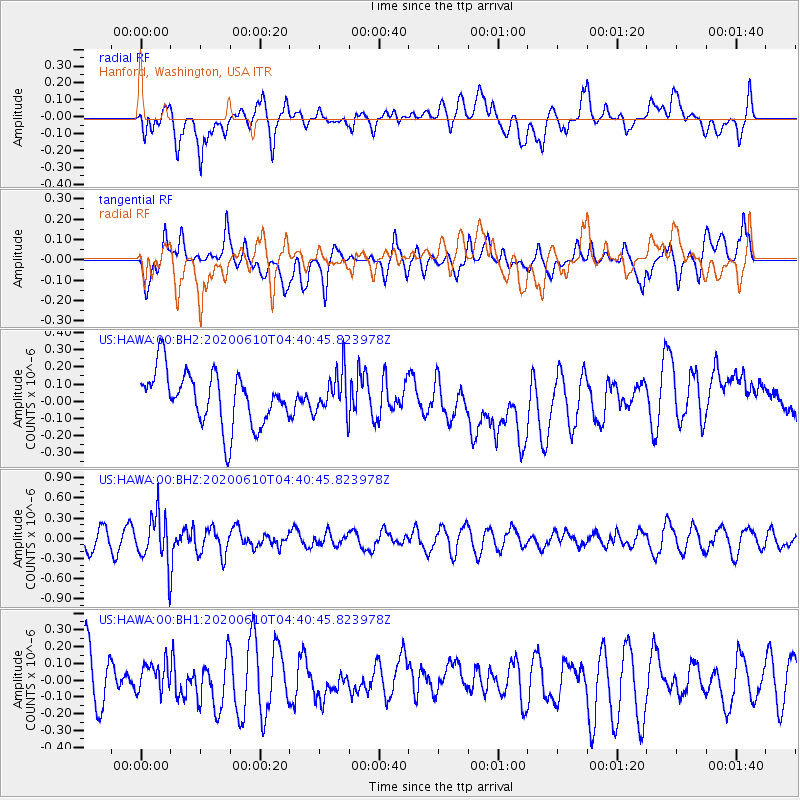
HAWA Hanford, Washington, USA - Earthquake Result Viewer
*The percent match for this event was below the threshold and hence no stack was calculated.
| Earthquake location: |
South Of Fiji Islands |
| Earthquake latitude/longitude: |
-23.5/179.2 |
| Earthquake time(UTC): |
2020/06/10 (162) 04:29:20 GMT |
| Earthquake Depth: |
539 km |
| Earthquake Magnitude: |
5.9 Mww |
| Earthquake Catalog/Contributor: |
NEIC PDE/us |
|
| Network: |
US United States National Seismic Network |
| Station: |
HAWA Hanford, Washington, USA |
| Lat/Lon: |
46.39 N/119.53 W |
| Elevation: |
364 m |
|
| Distance: |
88.9 deg |
| Az: |
37.365 deg |
| Baz: |
233.602 deg |
| Ray Param: |
$rayparam |
*The percent match for this event was below the threshold and hence was not used in the summary stack. |
|
| Radial Match: |
50.52386 % |
| Radial Bump: |
400 |
| Transverse Match: |
53.529198 % |
| Transverse Bump: |
400 |
| SOD ConfigId: |
21166931 |
| Insert Time: |
2020-06-24 04:45:21.704 +0000 |
| GWidth: |
2.5 |
| Max Bumps: |
400 |
| Tol: |
0.001 |
|
Signal To Noise
| Channel | StoN | STA | LTA |
| US:HAWA:00:BHZ:20200610T04:40:45.823978Z | 2.473493 | 3.586497E-7 | 1.4499724E-7 |
| US:HAWA:00:BH1:20200610T04:40:45.823978Z | 0.4949479 | 8.825989E-8 | 1.7832157E-7 |
| US:HAWA:00:BH2:20200610T04:40:45.823978Z | 0.78856224 | 1.2200013E-7 | 1.5471211E-7 |
| Arrivals |
| Ps | |
| PpPs | |
| PsPs/PpSs | |


