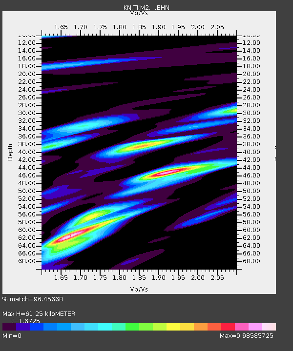
TKM2 KN.TKM2 - Earthquake Result Viewer
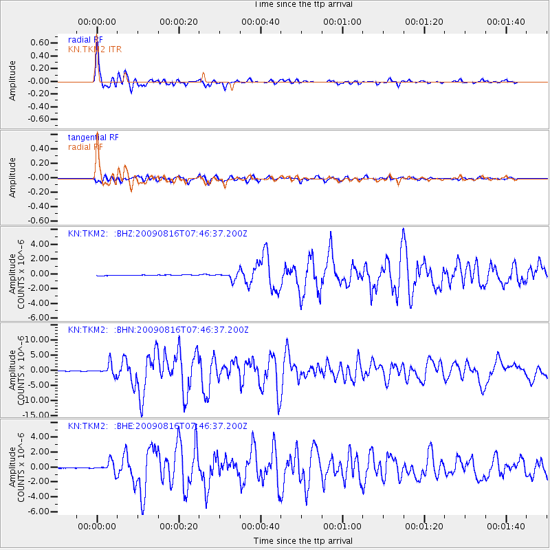
Earthquake location: Southern Sumatra, Indonesia
Earthquake latitude/longitude: -1.5/99.5
Earthquake time(UTC): 2009/08/16 (228) 07:38:21 GMT
Earthquake Depth: 20 km
Earthquake Magnitude: 6.5 MB, 6.7 MS, 6.7 MW, 6.5 MW
Earthquake Catalog/Contributor: WHDF/NEIC
Network: KN Kyrgyz Seismic Telemetry Network
Station: TKM2 KN.TKM2
Lat/Lon: 42.92 N/75.60 E
Elevation: 2020 m
Distance: 49.2 deg
Az: 336.84 deg
Baz: 147.64 deg
Ray Param: 0.06885572
Estimated Moho Depth: 61.25 km
Estimated Crust Vp/Vs: 1.67
Assumed Crust Vp: 6.306 km/s
Estimated Crust Vs: 3.77 km/s
Estimated Crust Poisson's Ratio: 0.22
Radial Match: 96.45668 %
Radial Bump: 400
Transverse Match: 92.042336 %
Transverse Bump: 400
SOD ConfigId: 2622
Insert Time: 2010-03-08 21:13:16.956 +0000
GWidth: 2.5
Max Bumps: 400
Tol: 0.001

Signal To Noise

ChannelStoNSTALTA
KN:TKM2: :BHN:20090816T07:46:37.200Z38.303961.8874969E-64.927681E-8
KN:TKM2: :BHE:20090816T07:46:37.200Z18.5449877.548743E-74.0705032E-8
KN:TKM2: :BHZ:20090816T07:46:37.200Z10.7232594.980162E-74.644262E-8
Arrivals
Ps6.9 SECOND
PpPs24 SECOND
PsPs/PpSs31 SECOND