You are here: Home > Network List > UW - Pacific Northwest Regional Seismic Network Stations List
> Station UMAT Pilot Rock, OR, USA > Earthquake Result Viewer
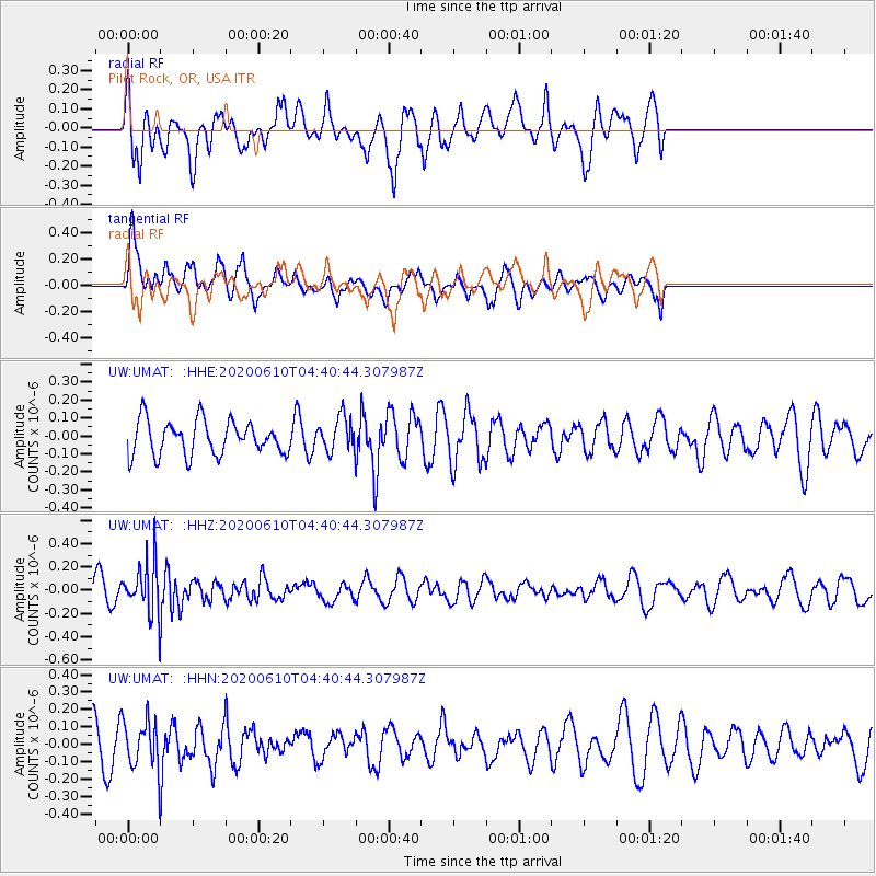
UMAT Pilot Rock, OR, USA - Earthquake Result Viewer
*The percent match for this event was below the threshold and hence no stack was calculated.
| Earthquake location: |
South Of Fiji Islands |
| Earthquake latitude/longitude: |
-23.5/179.2 |
| Earthquake time(UTC): |
2020/06/10 (162) 04:29:20 GMT |
| Earthquake Depth: |
539 km |
| Earthquake Magnitude: |
5.9 Mww |
| Earthquake Catalog/Contributor: |
NEIC PDE/us |
|
| Network: |
UW Pacific Northwest Regional Seismic Network |
| Station: |
UMAT Pilot Rock, OR, USA |
| Lat/Lon: |
45.29 N/118.96 W |
| Elevation: |
1318 m |
|
| Distance: |
88.6 deg |
| Az: |
38.492 deg |
| Baz: |
234.037 deg |
| Ray Param: |
$rayparam |
*The percent match for this event was below the threshold and hence was not used in the summary stack. |
|
| Radial Match: |
78.86318 % |
| Radial Bump: |
400 |
| Transverse Match: |
68.49113 % |
| Transverse Bump: |
400 |
| SOD ConfigId: |
21166931 |
| Insert Time: |
2020-06-24 04:46:44.674 +0000 |
| GWidth: |
2.5 |
| Max Bumps: |
400 |
| Tol: |
0.001 |
|
Signal To Noise
| Channel | StoN | STA | LTA |
| UW:UMAT: :HHZ:20200610T04:40:44.307987Z | 2.044857 | 2.0709294E-7 | 1.0127503E-7 |
| UW:UMAT: :HHN:20200610T04:40:44.307987Z | 1.6739743 | 1.2822402E-7 | 7.659856E-8 |
| UW:UMAT: :HHE:20200610T04:40:44.307987Z | 1.0055635 | 9.567396E-8 | 9.514463E-8 |
| Arrivals |
| Ps | |
| PpPs | |
| PsPs/PpSs | |


