You are here: Home > Network List > KN - Kyrgyz Seismic Telemetry Network Stations List
> Station TKM2 KN.TKM2 > Earthquake Result Viewer
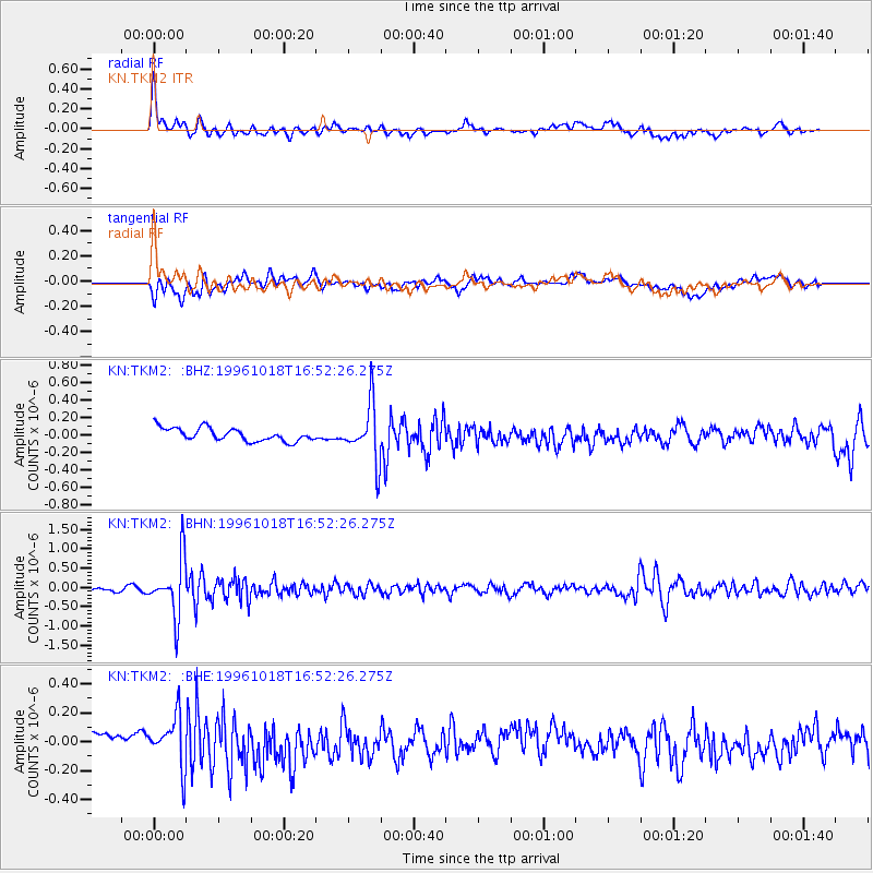
TKM2 KN.TKM2 - Earthquake Result Viewer
*The percent match for this event was below the threshold and hence no stack was calculated.
| Earthquake location: |
Near S. Coast Of Honshu, Japan |
| Earthquake latitude/longitude: |
33.7/137.4 |
| Earthquake time(UTC): |
1996/10/18 (292) 16:44:47 GMT |
| Earthquake Depth: |
338 km |
| Earthquake Magnitude: |
5.6 UNKNOWN, 5.4 MB, 5.6 MW |
| Earthquake Catalog/Contributor: |
WHDF/NEIC |
|
| Network: |
KN Kyrgyz Seismic Telemetry Network |
| Station: |
TKM2 KN.TKM2 |
| Lat/Lon: |
42.92 N/75.60 E |
| Elevation: |
2020 m |
|
| Distance: |
48.4 deg |
| Az: |
300.026 deg |
| Baz: |
79.348 deg |
| Ray Param: |
$rayparam |
*The percent match for this event was below the threshold and hence was not used in the summary stack. |
|
| Radial Match: |
71.157616 % |
| Radial Bump: |
400 |
| Transverse Match: |
54.5148 % |
| Transverse Bump: |
400 |
| SOD ConfigId: |
4480 |
| Insert Time: |
2010-03-08 21:14:03.867 +0000 |
| GWidth: |
2.5 |
| Max Bumps: |
400 |
| Tol: |
0.001 |
|
Signal To Noise
| Channel | StoN | STA | LTA |
| KN:TKM2: :BHN:19961018T16:52:26.275Z | 11.600126 | 7.303438E-7 | 6.2959984E-8 |
| KN:TKM2: :BHE:19961018T16:52:26.275Z | 2.767501 | 1.7941963E-7 | 6.4830914E-8 |
| KN:TKM2: :BHZ:19961018T16:52:26.275Z | 4.3788195 | 3.2054092E-7 | 7.3202585E-8 |
| Arrivals |
| Ps | |
| PpPs | |
| PsPs/PpSs | |


