You are here: Home > Network List > KN - Kyrgyz Seismic Telemetry Network Stations List
> Station TKM2 KN.TKM2 > Earthquake Result Viewer
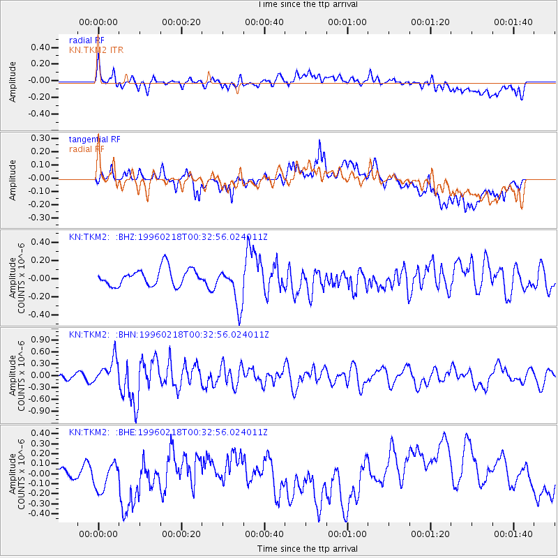
TKM2 KN.TKM2 - Earthquake Result Viewer
*The percent match for this event was below the threshold and hence no stack was calculated.
| Earthquake location: |
Irian Jaya Region, Indonesia |
| Earthquake latitude/longitude: |
-0.7/135.9 |
| Earthquake time(UTC): |
1996/02/18 (049) 00:22:23 GMT |
| Earthquake Depth: |
33 km |
| Earthquake Magnitude: |
5.7 MS, 5.2 MB |
| Earthquake Catalog/Contributor: |
WHDF/NEIC |
|
| Network: |
KN Kyrgyz Seismic Telemetry Network |
| Station: |
TKM2 KN.TKM2 |
| Lat/Lon: |
42.92 N/75.60 E |
| Elevation: |
2020 m |
|
| Distance: |
69.2 deg |
| Az: |
316.96 deg |
| Baz: |
111.714 deg |
| Ray Param: |
$rayparam |
*The percent match for this event was below the threshold and hence was not used in the summary stack. |
|
| Radial Match: |
51.24133 % |
| Radial Bump: |
400 |
| Transverse Match: |
45.300854 % |
| Transverse Bump: |
400 |
| SOD ConfigId: |
4480 |
| Insert Time: |
2010-03-08 21:14:06.879 +0000 |
| GWidth: |
2.5 |
| Max Bumps: |
400 |
| Tol: |
0.001 |
|
Signal To Noise
| Channel | StoN | STA | LTA |
| KN:TKM2: :BHN:19960218T00:32:56.024011Z | 3.1876454 | 3.207042E-7 | 1.00608496E-7 |
| KN:TKM2: :BHE:19960218T00:32:56.024011Z | 2.136371 | 2.0549211E-7 | 9.618748E-8 |
| KN:TKM2: :BHZ:19960218T00:32:56.024011Z | 2.4507792 | 2.2970563E-7 | 9.372759E-8 |
| Arrivals |
| Ps | |
| PpPs | |
| PsPs/PpSs | |


