You are here: Home > Network List > KN - Kyrgyz Seismic Telemetry Network Stations List
> Station TKM2 KN.TKM2 > Earthquake Result Viewer
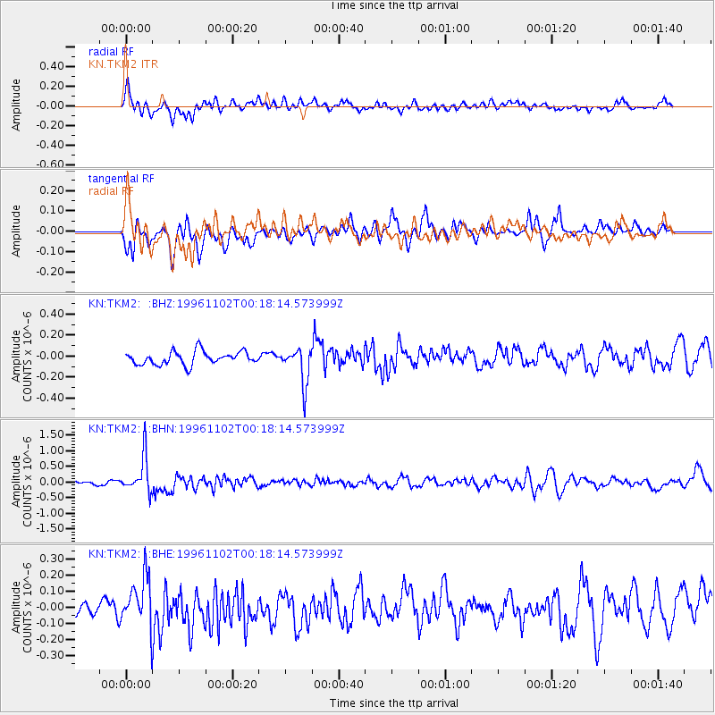
TKM2 KN.TKM2 - Earthquake Result Viewer
*The percent match for this event was below the threshold and hence no stack was calculated.
| Earthquake location: |
Bali Sea |
| Earthquake latitude/longitude: |
-7.6/117.3 |
| Earthquake time(UTC): |
1996/11/02 (307) 00:08:50 GMT |
| Earthquake Depth: |
302 km |
| Earthquake Magnitude: |
5.5 MB, 5.8 UNKNOWN, 5.8 MW |
| Earthquake Catalog/Contributor: |
WHDF/NEIC |
|
| Network: |
KN Kyrgyz Seismic Telemetry Network |
| Station: |
TKM2 KN.TKM2 |
| Lat/Lon: |
42.92 N/75.60 E |
| Elevation: |
2020 m |
|
| Distance: |
62.9 deg |
| Az: |
326.714 deg |
| Baz: |
132.207 deg |
| Ray Param: |
$rayparam |
*The percent match for this event was below the threshold and hence was not used in the summary stack. |
|
| Radial Match: |
61.528675 % |
| Radial Bump: |
400 |
| Transverse Match: |
68.369026 % |
| Transverse Bump: |
400 |
| SOD ConfigId: |
4480 |
| Insert Time: |
2010-03-08 21:14:08.450 +0000 |
| GWidth: |
2.5 |
| Max Bumps: |
400 |
| Tol: |
0.001 |
|
Signal To Noise
| Channel | StoN | STA | LTA |
| KN:TKM2: :BHN:19961102T00:18:14.573999Z | 12.099296 | 5.8477224E-7 | 4.83311E-8 |
| KN:TKM2: :BHE:19961102T00:18:14.573999Z | 2.863313 | 1.5361479E-7 | 5.364932E-8 |
| KN:TKM2: :BHZ:19961102T00:18:14.573999Z | 2.8245988 | 1.7562421E-7 | 6.2176696E-8 |
| Arrivals |
| Ps | |
| PpPs | |
| PsPs/PpSs | |


