You are here: Home > Network List > KN - Kyrgyz Seismic Telemetry Network Stations List
> Station TKM2 KN.TKM2 > Earthquake Result Viewer
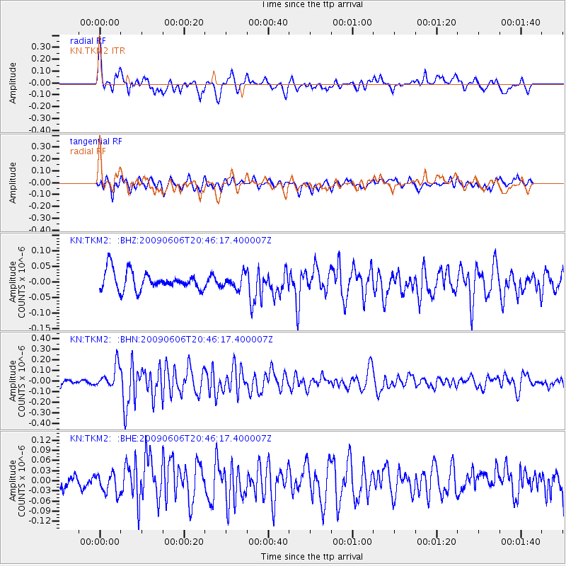
TKM2 KN.TKM2 - Earthquake Result Viewer
*The percent match for this event was below the threshold and hence no stack was calculated.
| Earthquake location: |
Northern Mid-Atlantic Ridge |
| Earthquake latitude/longitude: |
23.9/-46.1 |
| Earthquake time(UTC): |
2009/06/06 (157) 20:33:28 GMT |
| Earthquake Depth: |
14 km |
| Earthquake Magnitude: |
6.0 MB, 5.7 MS, 6.0 MW, 6.0 MW |
| Earthquake Catalog/Contributor: |
WHDF/NEIC |
|
| Network: |
KN Kyrgyz Seismic Telemetry Network |
| Station: |
TKM2 KN.TKM2 |
| Lat/Lon: |
42.92 N/75.60 E |
| Elevation: |
2020 m |
|
| Distance: |
94.6 deg |
| Az: |
38.829 deg |
| Baz: |
308.607 deg |
| Ray Param: |
$rayparam |
*The percent match for this event was below the threshold and hence was not used in the summary stack. |
|
| Radial Match: |
75.12124 % |
| Radial Bump: |
400 |
| Transverse Match: |
72.43466 % |
| Transverse Bump: |
400 |
| SOD ConfigId: |
2648 |
| Insert Time: |
2010-03-08 21:14:17.219 +0000 |
| GWidth: |
2.5 |
| Max Bumps: |
400 |
| Tol: |
0.001 |
|
Signal To Noise
| Channel | StoN | STA | LTA |
| KN:TKM2: :BHN:20090606T20:46:17.400007Z | 3.0110192 | 1.08199025E-7 | 3.5934352E-8 |
| KN:TKM2: :BHE:20090606T20:46:17.400007Z | 1.4389876 | 2.8726422E-8 | 1.996294E-8 |
| KN:TKM2: :BHZ:20090606T20:46:17.400007Z | 0.7550657 | 2.2572937E-8 | 2.989533E-8 |
| Arrivals |
| Ps | |
| PpPs | |
| PsPs/PpSs | |


