You are here: Home > Network List > KN - Kyrgyz Seismic Telemetry Network Stations List
> Station TKM2 KN.TKM2 > Earthquake Result Viewer
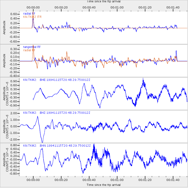
TKM2 KN.TKM2 - Earthquake Result Viewer
*The percent match for this event was below the threshold and hence no stack was calculated.
| Earthquake location: |
East Of Kuril Islands |
| Earthquake latitude/longitude: |
47.5/155.1 |
| Earthquake time(UTC): |
1994/11/15 (319) 20:39:40 GMT |
| Earthquake Depth: |
33 km |
| Earthquake Magnitude: |
5.7 MB, 6.0 MS, 5.6 UNKNOWN, 6.0 MW |
| Earthquake Catalog/Contributor: |
WHDF/NEIC |
|
| Network: |
KN Kyrgyz Seismic Telemetry Network |
| Station: |
TKM2 KN.TKM2 |
| Lat/Lon: |
42.92 N/75.60 E |
| Elevation: |
2020 m |
|
| Distance: |
53.9 deg |
| Az: |
296.628 deg |
| Baz: |
55.671 deg |
| Ray Param: |
$rayparam |
*The percent match for this event was below the threshold and hence was not used in the summary stack. |
|
| Radial Match: |
59.146603 % |
| Radial Bump: |
400 |
| Transverse Match: |
49.057167 % |
| Transverse Bump: |
288 |
| SOD ConfigId: |
4480 |
| Insert Time: |
2010-03-08 21:14:26.257 +0000 |
| GWidth: |
2.5 |
| Max Bumps: |
400 |
| Tol: |
0.001 |
|
Signal To Noise
| Channel | StoN | STA | LTA |
| KN:TKM2: :BHZ:19941115T20:48:29.750012Z | 2.3818574 | 6.988717E-7 | 2.934146E-7 |
| KN:TKM2: :BHN:19941115T20:48:29.750012Z | 0.5219293 | 1.2752422E-7 | 2.4433234E-7 |
| KN:TKM2: :BHE:19941115T20:48:29.750012Z | 1.734517 | 3.6867334E-7 | 2.12551E-7 |
| Arrivals |
| Ps | |
| PpPs | |
| PsPs/PpSs | |


