You are here: Home > Network List > KN - Kyrgyz Seismic Telemetry Network Stations List
> Station TKM2 KN.TKM2 > Earthquake Result Viewer
TKM2 KN.TKM2 - Earthquake Result Viewer
*The percent match for this event was below the threshold and hence no stack was calculated.
| Earthquake location: |
Southwest Of Sumatra, Indonesia |
| Earthquake latitude/longitude: |
-6.1/103.5 |
| Earthquake time(UTC): |
2008/12/17 (352) 16:06:58 GMT |
| Earthquake Depth: |
35 km |
| Earthquake Magnitude: |
5.7 MB, 4.6 MS, 5.2 MW, 5.2 MW |
| Earthquake Catalog/Contributor: |
WHDF/NEIC |
|
| Network: |
KN Kyrgyz Seismic Telemetry Network |
| Station: |
TKM2 KN.TKM2 |
| Lat/Lon: |
42.92 N/75.60 E |
| Elevation: |
2020 m |
|
| Distance: |
55.0 deg |
| Az: |
335.161 deg |
| Baz: |
145.34 deg |
| Ray Param: |
$rayparam |
*The percent match for this event was below the threshold and hence was not used in the summary stack. |
|
| Radial Match: |
64.47801 % |
| Radial Bump: |
400 |
| Transverse Match: |
54.044548 % |
| Transverse Bump: |
400 |
| SOD ConfigId: |
2658 |
| Insert Time: |
2010-03-08 21:14:27.958 +0000 |
| GWidth: |
2.5 |
| Max Bumps: |
400 |
| Tol: |
0.001 |
|
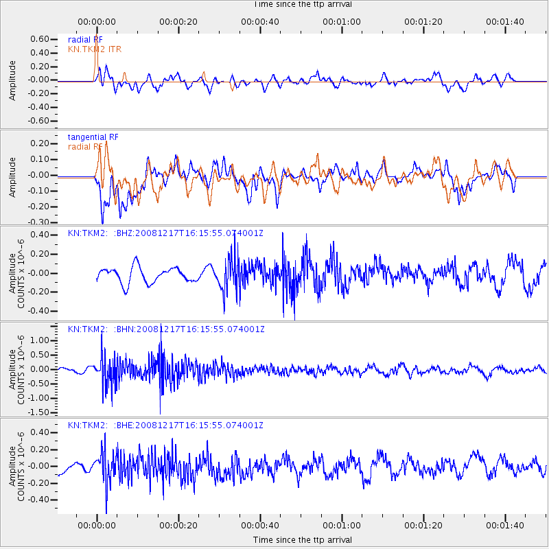
Signal To Noise
| Channel | StoN | STA | LTA |
| KN:TKM2: :BHN:20081217T16:15:55.074001Z | 4.9309893 | 4.7099206E-7 | 9.551675E-8 |
| KN:TKM2: :BHE:20081217T16:15:55.074001Z | 2.7588418 | 1.7930114E-7 | 6.4991454E-8 |
| KN:TKM2: :BHZ:20081217T16:15:55.074001Z | 2.136196 | 1.7215E-7 | 8.058718E-8 |
| Arrivals |
| Ps | |
| PpPs | |
| PsPs/PpSs | |


