You are here: Home > Network List > GS - US Geological Survey Networks Stations List
> Station KAN13 Rinehart Farm > Earthquake Result Viewer
KAN13 Rinehart Farm - Earthquake Result Viewer
*The percent match for this event was below the threshold and hence no stack was calculated.
| Earthquake location: |
Aegean Sea |
| Earthquake latitude/longitude: |
38.9/26.4 |
| Earthquake time(UTC): |
2017/06/12 (163) 12:28:38 GMT |
| Earthquake Depth: |
10 km |
| Earthquake Magnitude: |
6.3 Mww |
| Earthquake Catalog/Contributor: |
NEIC PDE/us |
|
| Network: |
GS US Geological Survey Networks |
| Station: |
KAN13 Rinehart Farm |
| Lat/Lon: |
37.01 N/97.48 W |
| Elevation: |
340 m |
|
| Distance: |
88.4 deg |
| Az: |
318.311 deg |
| Baz: |
40.395 deg |
| Ray Param: |
$rayparam |
*The percent match for this event was below the threshold and hence was not used in the summary stack. |
|
| Radial Match: |
34.919037 % |
| Radial Bump: |
400 |
| Transverse Match: |
33.660095 % |
| Transverse Bump: |
400 |
| SOD ConfigId: |
2140511 |
| Insert Time: |
2017-06-26 04:22:16.786 +0000 |
| GWidth: |
2.5 |
| Max Bumps: |
400 |
| Tol: |
0.001 |
|
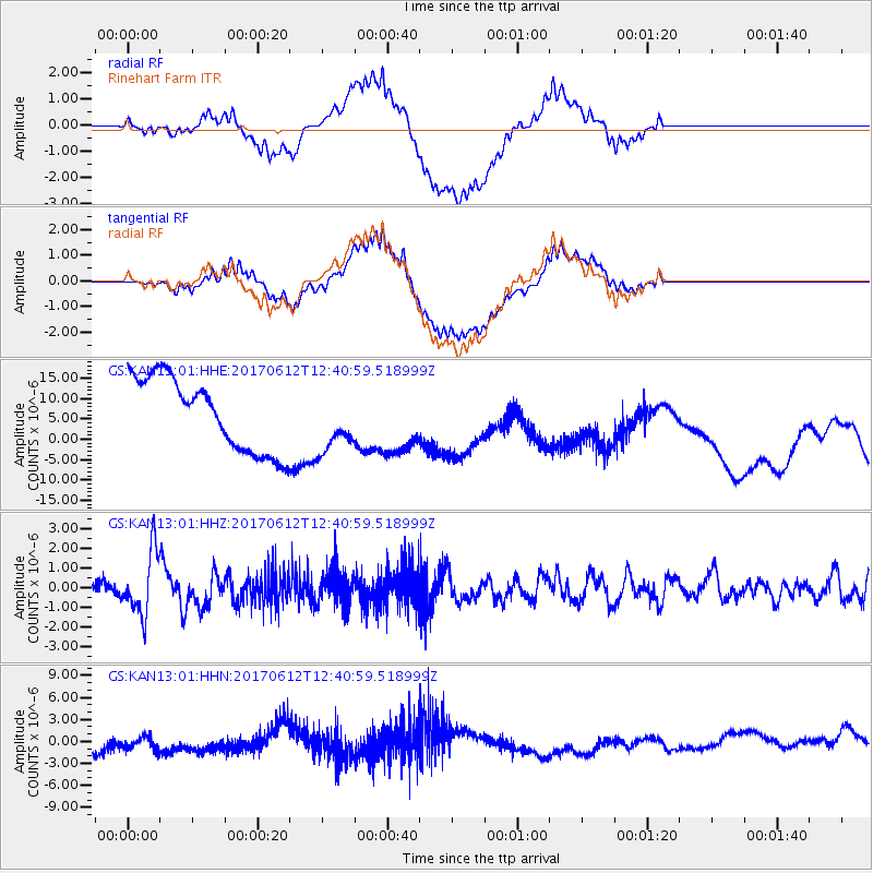
Signal To Noise
| Channel | StoN | STA | LTA |
| GS:KAN13:01:HHZ:20170612T12:40:59.518999Z | 4.486534 | 1.5890939E-6 | 3.5419188E-7 |
| GS:KAN13:01:HHN:20170612T12:40:59.518999Z | 0.9595228 | 1.2897384E-6 | 1.3441457E-6 |
| GS:KAN13:01:HHE:20170612T12:40:59.518999Z | 0.8306226 | 7.4012323E-6 | 8.910463E-6 |
| Arrivals |
| Ps | |
| PpPs | |
| PsPs/PpSs | |


