You are here: Home > Network List > KN - Kyrgyz Seismic Telemetry Network Stations List
> Station TKM2 KN.TKM2 > Earthquake Result Viewer
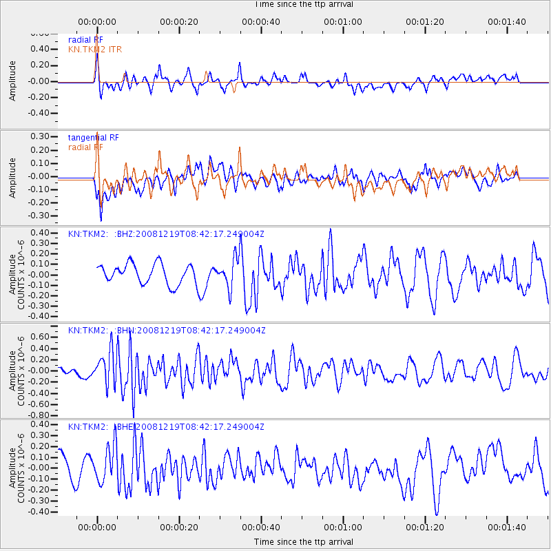
TKM2 KN.TKM2 - Earthquake Result Viewer
*The percent match for this event was below the threshold and hence no stack was calculated.
| Earthquake location: |
Northern Mid-Atlantic Ridge |
| Earthquake latitude/longitude: |
47.0/-27.3 |
| Earthquake time(UTC): |
2008/12/19 (354) 08:31:51 GMT |
| Earthquake Depth: |
2.0 km |
| Earthquake Magnitude: |
5.8 MB, 5.6 MS, 5.9 MW, 5.8 MW |
| Earthquake Catalog/Contributor: |
WHDF/NEIC |
|
| Network: |
KN Kyrgyz Seismic Telemetry Network |
| Station: |
TKM2 KN.TKM2 |
| Lat/Lon: |
42.92 N/75.60 E |
| Elevation: |
2020 m |
|
| Distance: |
67.5 deg |
| Az: |
50.808 deg |
| Baz: |
313.769 deg |
| Ray Param: |
$rayparam |
*The percent match for this event was below the threshold and hence was not used in the summary stack. |
|
| Radial Match: |
62.770576 % |
| Radial Bump: |
400 |
| Transverse Match: |
40.11197 % |
| Transverse Bump: |
400 |
| SOD ConfigId: |
2658 |
| Insert Time: |
2010-03-08 21:14:39.238 +0000 |
| GWidth: |
2.5 |
| Max Bumps: |
400 |
| Tol: |
0.001 |
|
Signal To Noise
| Channel | StoN | STA | LTA |
| KN:TKM2: :BHN:20081219T08:42:17.249004Z | 2.5333052 | 3.0136803E-7 | 1.1896238E-7 |
| KN:TKM2: :BHE:20081219T08:42:17.249004Z | 1.7765198 | 1.9142921E-7 | 1.0775518E-7 |
| KN:TKM2: :BHZ:20081219T08:42:17.249004Z | 1.529153 | 1.4523198E-7 | 9.497544E-8 |
| Arrivals |
| Ps | |
| PpPs | |
| PsPs/PpSs | |


