You are here: Home > Network List > KN - Kyrgyz Seismic Telemetry Network Stations List
> Station TKM2 KN.TKM2 > Earthquake Result Viewer
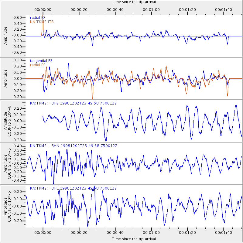
TKM2 KN.TKM2 - Earthquake Result Viewer
*The percent match for this event was below the threshold and hence no stack was calculated.
| Earthquake location: |
Mid-Indian Ridge |
| Earthquake latitude/longitude: |
-9.1/67.5 |
| Earthquake time(UTC): |
1998/12/02 (336) 23:41:17 GMT |
| Earthquake Depth: |
10 km |
| Earthquake Magnitude: |
5.9 UNKNOWN, 5.2 MS, 5.0 MB, 5.7 MW |
| Earthquake Catalog/Contributor: |
WHDF/NEIC |
|
| Network: |
KN Kyrgyz Seismic Telemetry Network |
| Station: |
TKM2 KN.TKM2 |
| Lat/Lon: |
42.92 N/75.60 E |
| Elevation: |
2020 m |
|
| Distance: |
52.3 deg |
| Az: |
7.547 deg |
| Baz: |
190.169 deg |
| Ray Param: |
$rayparam |
*The percent match for this event was below the threshold and hence was not used in the summary stack. |
|
| Radial Match: |
65.95743 % |
| Radial Bump: |
400 |
| Transverse Match: |
77.81268 % |
| Transverse Bump: |
400 |
| SOD ConfigId: |
4480 |
| Insert Time: |
2010-03-08 21:14:43.210 +0000 |
| GWidth: |
2.5 |
| Max Bumps: |
400 |
| Tol: |
0.001 |
|
Signal To Noise
| Channel | StoN | STA | LTA |
| KN:TKM2: :BHN:19981202T23:49:58.750012Z | 1.214198 | 1.686116E-7 | 1.3886665E-7 |
| KN:TKM2: :BHE:19981202T23:49:58.750012Z | 1.2173437 | 9.110805E-8 | 7.484168E-8 |
| KN:TKM2: :BHZ:19981202T23:49:58.750012Z | 2.3472238 | 1.6930676E-7 | 7.2130646E-8 |
| Arrivals |
| Ps | |
| PpPs | |
| PsPs/PpSs | |


