You are here: Home > Network List > GS - US Geological Survey Networks Stations List
> Station OK051 E0350 and S34600 Roads, Ralston, OK > Earthquake Result Viewer
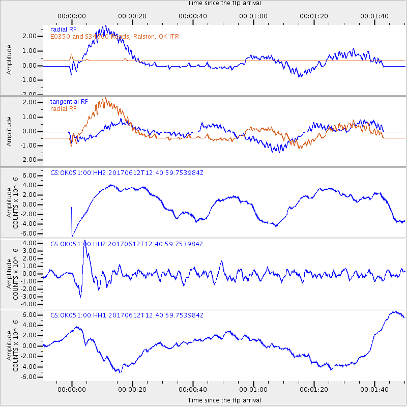
OK051 E0350 and S34600 Roads, Ralston, OK - Earthquake Result Viewer
*The percent match for this event was below the threshold and hence no stack was calculated.
| Earthquake location: |
Aegean Sea |
| Earthquake latitude/longitude: |
38.9/26.4 |
| Earthquake time(UTC): |
2017/06/12 (163) 12:28:38 GMT |
| Earthquake Depth: |
10 km |
| Earthquake Magnitude: |
6.3 Mww |
| Earthquake Catalog/Contributor: |
NEIC PDE/us |
|
| Network: |
GS US Geological Survey Networks |
| Station: |
OK051 E0350 and S34600 Roads, Ralston, OK |
| Lat/Lon: |
36.51 N/96.84 W |
| Elevation: |
263 m |
|
| Distance: |
88.5 deg |
| Az: |
317.59 deg |
| Baz: |
40.758 deg |
| Ray Param: |
$rayparam |
*The percent match for this event was below the threshold and hence was not used in the summary stack. |
|
| Radial Match: |
24.479273 % |
| Radial Bump: |
400 |
| Transverse Match: |
37.409634 % |
| Transverse Bump: |
400 |
| SOD ConfigId: |
2140511 |
| Insert Time: |
2017-06-26 04:22:29.791 +0000 |
| GWidth: |
2.5 |
| Max Bumps: |
400 |
| Tol: |
0.001 |
|
Signal To Noise
| Channel | StoN | STA | LTA |
| GS:OK051:00:HHZ:20170612T12:40:59.753984Z | 9.496237 | 2.0572427E-6 | 2.1663766E-7 |
| GS:OK051:00:HH1:20170612T12:40:59.753984Z | 0.88534796 | 4.0776517E-6 | 4.6057053E-6 |
| GS:OK051:00:HH2:20170612T12:40:59.753984Z | 0.88695467 | 2.6311973E-6 | 2.966552E-6 |
| Arrivals |
| Ps | |
| PpPs | |
| PsPs/PpSs | |


