You are here: Home > Network List > KN - Kyrgyz Seismic Telemetry Network Stations List
> Station TKM2 KN.TKM2 > Earthquake Result Viewer
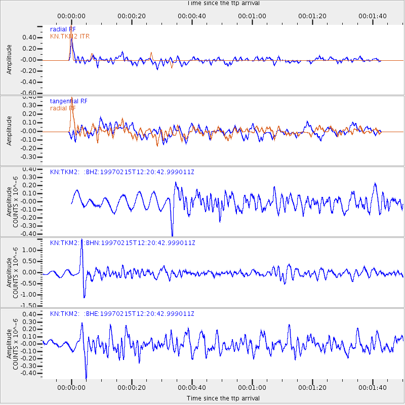
TKM2 KN.TKM2 - Earthquake Result Viewer
*The percent match for this event was below the threshold and hence no stack was calculated.
| Earthquake location: |
Bali Sea |
| Earthquake latitude/longitude: |
-7.8/117.4 |
| Earthquake time(UTC): |
1997/02/15 (046) 12:11:14 GMT |
| Earthquake Depth: |
274 km |
| Earthquake Magnitude: |
5.6 MB, 5.6 UNKNOWN, 5.6 MW |
| Earthquake Catalog/Contributor: |
WHDF/NEIC |
|
| Network: |
KN Kyrgyz Seismic Telemetry Network |
| Station: |
TKM2 KN.TKM2 |
| Lat/Lon: |
42.92 N/75.60 E |
| Elevation: |
2020 m |
|
| Distance: |
63.2 deg |
| Az: |
326.714 deg |
| Baz: |
132.24 deg |
| Ray Param: |
$rayparam |
*The percent match for this event was below the threshold and hence was not used in the summary stack. |
|
| Radial Match: |
63.12125 % |
| Radial Bump: |
400 |
| Transverse Match: |
74.386284 % |
| Transverse Bump: |
400 |
| SOD ConfigId: |
4480 |
| Insert Time: |
2010-03-08 21:14:45.996 +0000 |
| GWidth: |
2.5 |
| Max Bumps: |
400 |
| Tol: |
0.001 |
|
Signal To Noise
| Channel | StoN | STA | LTA |
| KN:TKM2: :BHN:19970215T12:20:42.999011Z | 9.9464245 | 5.897299E-7 | 5.9290638E-8 |
| KN:TKM2: :BHE:19970215T12:20:42.999011Z | 4.0628753 | 1.4781895E-7 | 3.6382847E-8 |
| KN:TKM2: :BHZ:19970215T12:20:42.999011Z | 2.2828379 | 1.5872897E-7 | 6.953143E-8 |
| Arrivals |
| Ps | |
| PpPs | |
| PsPs/PpSs | |


