You are here: Home > Network List > KN - Kyrgyz Seismic Telemetry Network Stations List
> Station TKM2 KN.TKM2 > Earthquake Result Viewer
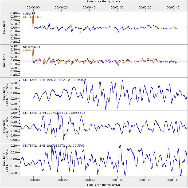
TKM2 KN.TKM2 - Earthquake Result Viewer
*The percent match for this event was below the threshold and hence no stack was calculated.
| Earthquake location: |
Northern Mid-Atlantic Ridge |
| Earthquake latitude/longitude: |
31.0/-41.5 |
| Earthquake time(UTC): |
1997/03/23 (082) 20:48:48 GMT |
| Earthquake Depth: |
10 km |
| Earthquake Magnitude: |
5.9 MS, 5.4 MB, 5.9 UNKNOWN, 5.9 MW |
| Earthquake Catalog/Contributor: |
WHDF/NEIC |
|
| Network: |
KN Kyrgyz Seismic Telemetry Network |
| Station: |
TKM2 KN.TKM2 |
| Lat/Lon: |
42.92 N/75.60 E |
| Elevation: |
2020 m |
|
| Distance: |
86.6 deg |
| Az: |
40.91 deg |
| Baz: |
310.035 deg |
| Ray Param: |
$rayparam |
*The percent match for this event was below the threshold and hence was not used in the summary stack. |
|
| Radial Match: |
69.549225 % |
| Radial Bump: |
400 |
| Transverse Match: |
63.96437 % |
| Transverse Bump: |
400 |
| SOD ConfigId: |
4480 |
| Insert Time: |
2010-03-08 21:14:53.242 +0000 |
| GWidth: |
2.5 |
| Max Bumps: |
400 |
| Tol: |
0.001 |
|
Signal To Noise
| Channel | StoN | STA | LTA |
| KN:TKM2: :BHN:19970323T21:01:00.550Z | 1.9805025 | 1.3133597E-7 | 6.631446E-8 |
| KN:TKM2: :BHE:19970323T21:01:00.550Z | 1.066022 | 7.380981E-8 | 6.9238546E-8 |
| KN:TKM2: :BHZ:19970323T21:01:00.550Z | 1.1853161 | 6.92759E-8 | 5.844508E-8 |
| Arrivals |
| Ps | |
| PpPs | |
| PsPs/PpSs | |


