You are here: Home > Network List > KN - Kyrgyz Seismic Telemetry Network Stations List
> Station TKM2 KN.TKM2 > Earthquake Result Viewer
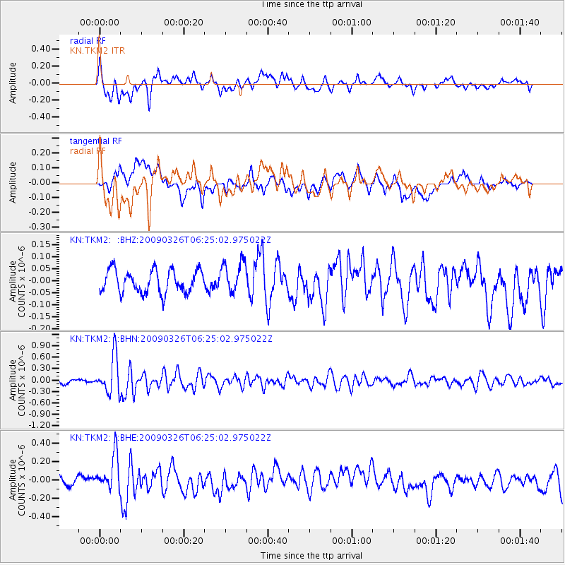
TKM2 KN.TKM2 - Earthquake Result Viewer
*The percent match for this event was below the threshold and hence no stack was calculated.
| Earthquake location: |
Mid-Indian Ridge |
| Earthquake latitude/longitude: |
-27.5/73.3 |
| Earthquake time(UTC): |
2009/03/26 (085) 06:14:22 GMT |
| Earthquake Depth: |
10 km |
| Earthquake Magnitude: |
5.7 MW, 5.4 MS, 5.4 MB, 5.6 MW |
| Earthquake Catalog/Contributor: |
WHDF/NEIC |
|
| Network: |
KN Kyrgyz Seismic Telemetry Network |
| Station: |
TKM2 KN.TKM2 |
| Lat/Lon: |
42.92 N/75.60 E |
| Elevation: |
2020 m |
|
| Distance: |
70.1 deg |
| Az: |
1.792 deg |
| Baz: |
182.168 deg |
| Ray Param: |
$rayparam |
*The percent match for this event was below the threshold and hence was not used in the summary stack. |
|
| Radial Match: |
69.82476 % |
| Radial Bump: |
400 |
| Transverse Match: |
67.029724 % |
| Transverse Bump: |
400 |
| SOD ConfigId: |
2658 |
| Insert Time: |
2010-03-08 21:15:03.054 +0000 |
| GWidth: |
2.5 |
| Max Bumps: |
400 |
| Tol: |
0.001 |
|
Signal To Noise
| Channel | StoN | STA | LTA |
| KN:TKM2: :BHN:20090326T06:25:02.975022Z | 7.9020944 | 5.088415E-7 | 6.439324E-8 |
| KN:TKM2: :BHE:20090326T06:25:02.975022Z | 4.118029 | 2.0020809E-7 | 4.8617455E-8 |
| KN:TKM2: :BHZ:20090326T06:25:02.975022Z | 1.4319385 | 6.714618E-8 | 4.6891806E-8 |
| Arrivals |
| Ps | |
| PpPs | |
| PsPs/PpSs | |


